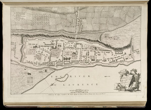
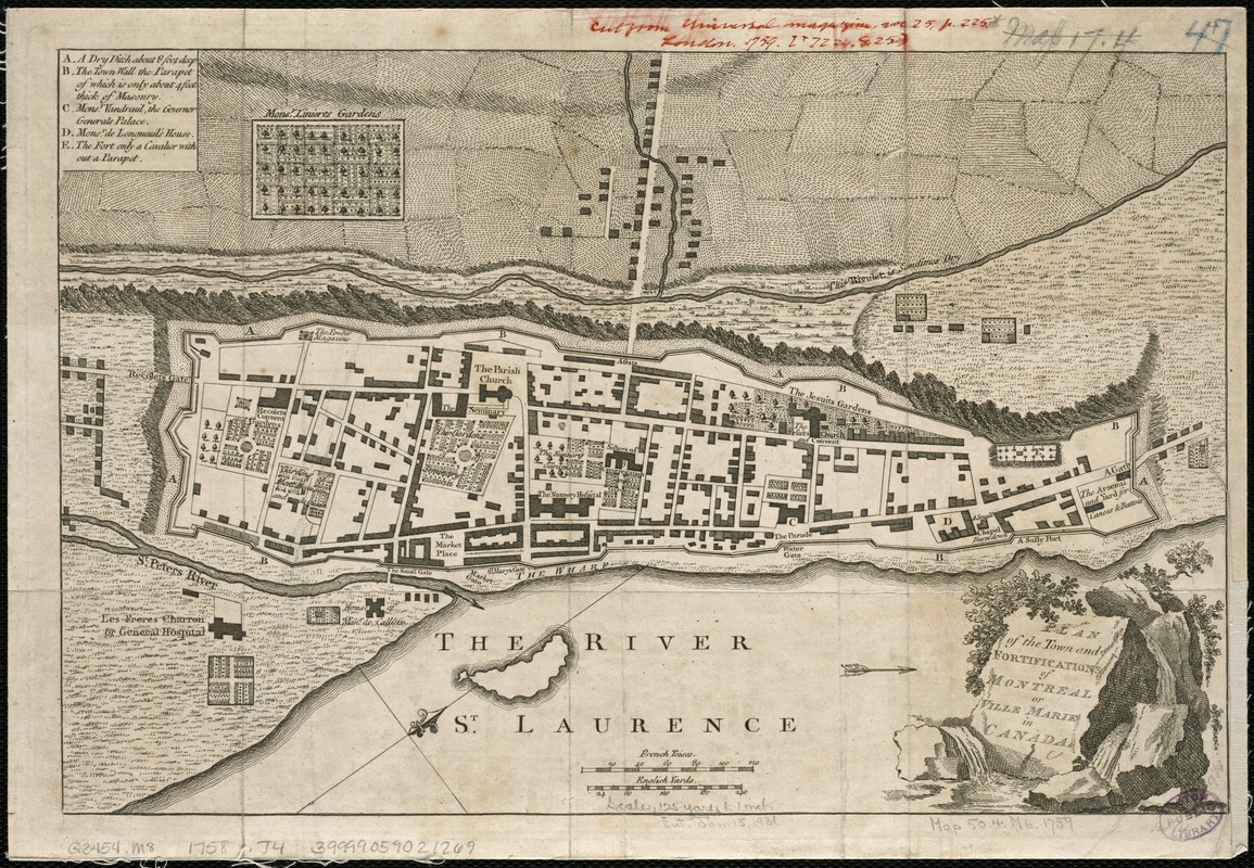
Plan of the town and fortifications of Montreal or Ville Marie in Canada
This map is also available in American Revolutionary Geographies Online (ARGO), a collections portal especially built for material relating to the American Revolutionary War Era. Visit ARGO to learn more about this item and explore the historical geography of North America in the late eighteenth century.
Item Information
- Title:
- Plan of the town and fortifications of Montreal or Ville Marie in Canada
- Creator:
- Jefferys, Thomas, d. 1771
- Date:
-
[1758]
- Format:
-
Maps/Atlases
- Location:
-
Boston Public Library
Norman B. Leventhal Map Center - Collection (local):
-
Norman B. Leventhal Map Center Collection
- Subjects:
-
Montréal (Québec)--Maps--Early works to 1800
- Places:
-
CanadaQuebec (province)Montreal
- Extent:
- 1 map ; 24 x 36 cm.
- Terms of Use:
-
No known copyright restrictions.
No known restrictions on use.
- Publisher:
-
London :
Thomas Jeffreys
- Scale:
-
Scale ca. 1:3,240.
- Language:
-
English
- Notes:
-
Oriented with north to the upper right.
Shows buildings and fortifications.
Publication data suggested by similar maps.
Cataloging, conservation, and digitization made possible in part by The National Endowment for the Humanities: Exploring the human endeavor.
- Notes (date):
-
This date is inferred.
- Identifier:
-
06_01_006197
- Call #:
-
G3454.M65 1758 .J4
- Barcode:
-
39999059021269