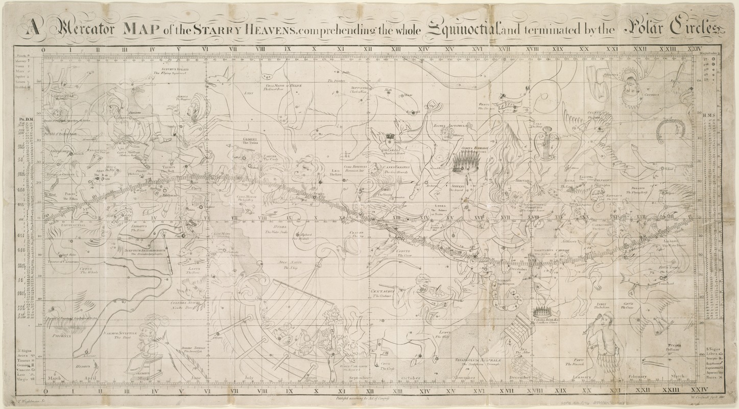
A Mercator map of the starry heavens, comprehending the whole equinoctial, and terminated by the polar circles
Item Information
- Title:
- A Mercator map of the starry heavens, comprehending the whole equinoctial, and terminated by the polar circles
- Creator:
- Croswell, William, 1760-1834
- Name on Item:
-
W. Croswell.
- Date:
-
1810
- Format:
-
Maps/Atlases
- Location:
-
Boston Public Library
Norman B. Leventhal Map Center - Collection (local):
-
Norman B. Leventhal Map Center Collection
- Subjects:
-
Constellations--Maps
Astronomy--Charts, diagrams, etc.
Stars--Maps
Zodiac--Maps
- Extent:
- 1 map ; 42 x 84 cm.
- Terms of Use:
-
No known copyright restrictions.
No known restrictions on use.
- Publisher:
-
[Boston] :
T. Wightman
- Scale:
-
Scale not given ;
- Language:
-
English
- Notes:
-
Relief shown pictorially.
Shows the path of the Great Comet of 1807, several planets, and the introduction of two constellations: Sciurus Volans (Flying Squirrel) and Marmor Sculptile (Bust of Columbus).
Pen-and-ink.
"Publish'd according to Act of Congress."
Accompanied by text: Description and exploration of the Mercator map of the starry heavens : with its application in the solutions of problems. 30 p. : ill. ; 24 cm.
Includes text and tables of information in left and right margins.
- Identifier:
-
06_01_006185
- Call #:
-
G3190 1810 .C76
- Barcode:
-
39999059021129
- LCCN:
-
2009575940