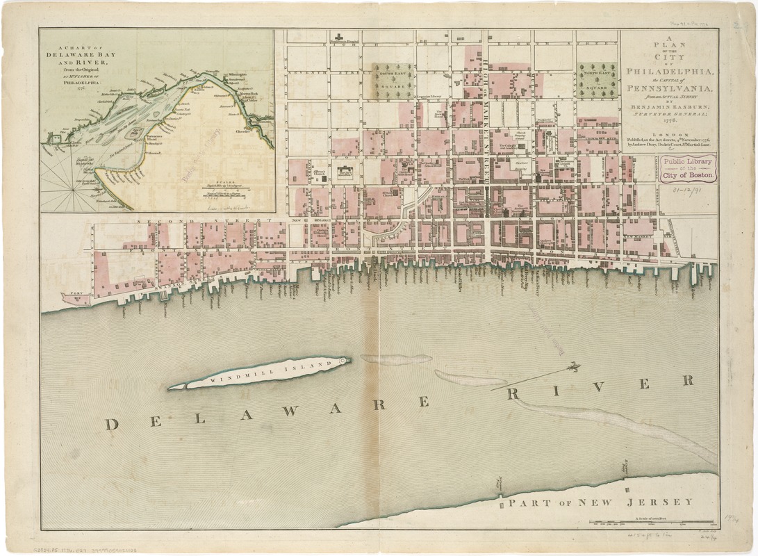
A plan of the city of Philadelphia, the capital of Pennsylvania, from an actual survey
This map is also available in American Revolutionary Geographies Online (ARGO), a collections portal especially built for material relating to the American Revolutionary War Era. Visit ARGO to learn more about this item and explore the historical geography of North America in the late eighteenth century.
Item Information
- Title:
- A plan of the city of Philadelphia, the capital of Pennsylvania, from an actual survey
- Creator:
- Easburn, Benjamin.
- Name on Item:
-
by Benjamin Easburn ; P. André, sculp.
- Date:
-
1776
- Format:
-
Maps/Atlases
- Location:
-
Boston Public Library
Norman B. Leventhal Map Center - Collection (local):
-
Norman B. Leventhal Map Center Collection
- Subjects:
-
Philadelphia (Pa.)--Maps--Early works to 1800
Delaware Bay (Del. and N.J.)--Maps--Early works to 1800
- Places:
-
Delaware Bay
Philadelphia (county)Philadelphia
- Extent:
- 1 map : hand col. ; 50 x 67 cm.
- Terms of Use:
-
No known copyright restrictions.
No known restrictions on use.
- Publisher:
-
London :
Andrew Dury
- Scale:
-
Scale [ca. 1:5,000]
- Language:
-
English
- Notes:
-
Oriented with north toward the upper right.
Shows name and location of important buildings and wharf facilities.
Inset: A chart of Delaware Bay and River, from the original by Mr. Fisher of Philadelphia, 1776 [ca. 1:700,000].
Cataloging, conservation, and digitization made possible in part by The National Endowment for the Humanities: Exploring the human endeavor.
- Identifier:
-
06_01_006181
- Call #:
-
G3824.P5 1776 .E27
- Barcode:
-
39999059021103