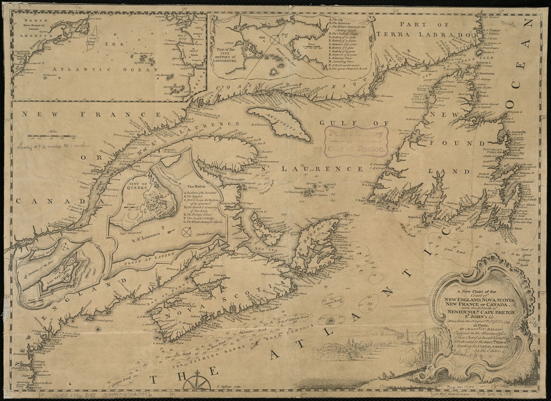
A new chart of the coast of New England, Nova Scotia, New France or Canada, with the islands of Newfoundld. Cape Breton St. John's &c : done from the original publish'd in 1744 at Paris
This map is also available in American Revolutionary Geographies Online (ARGO), a collections portal especially built for material relating to the American Revolutionary War Era. Visit ARGO to learn more about this item and explore the historical geography of North America in the late eighteenth century.
Item Information
- Title:
- A new chart of the coast of New England, Nova Scotia, New France or Canada, with the islands of Newfoundld. Cape Breton St. John's &c : done from the original publish'd in 1744 at Paris
- Creator:
- Bellin, Jacques Nicolas, 1703-1772
- Name on Item:
-
by Mons. N. Bellin ...
- Date:
-
[1746]
- Format:
-
Maps/Atlases
- Location:
-
Boston Public Library
Norman B. Leventhal Map Center - Collection (local):
-
Norman B. Leventhal Map Center Collection
- Subjects:
-
Canada--Maps--Early works to 1800
New France--Maps--Early works to 1800
New England--Maps--Early works to 1800
- Places:
-
New England (area)
New France (former administrative division)
Canada
- Extent:
- 1 map ; 34 x 47 cm.
- Terms of Use:
-
No known copyright restrictions.
No known restrictions on use.
- Publisher:
-
London :
s.n.
- Scale:
-
Scale [1:3,150,000].
- Language:
-
English
- Notes:
-
Depths shown by soundings.
"T. Jefferys sculp."
Inset maps: "The Atlantic Ocean," "Plan of the city and port of Louisbourg," "City of Quebec," and Fort Dauphin.
Decorative title cartouche.
Shows coastal landmarks and settlements, with shoals, islands and sand banks.
London meridian.
Cataloging, conservation, and digitization made possible in part by The National Endowment for the Humanities: Exploring the human endeavor.
Detached from Gentleman's magazine volume 16, January 1746.
- Notes (date):
-
This date is inferred.
- Identifier:
-
06_01_006169
- Call #:
-
G3400 1746 .B45
- Barcode:
-
39999059020956


