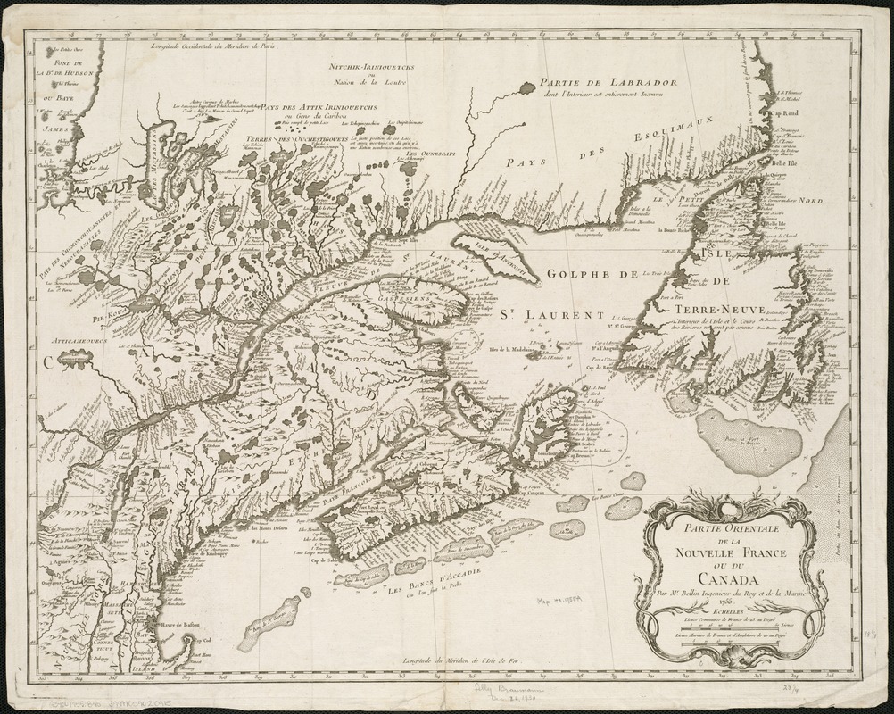
Partie orientale de la Nouvelle France ou du Canada
This map is also available in American Revolutionary Geographies Online (ARGO), a collections portal especially built for material relating to the American Revolutionary War Era. Visit ARGO to learn more about this item and explore the historical geography of North America in the late eighteenth century.
Item Information
- Title:
- Partie orientale de la Nouvelle France ou du Canada
- Creator:
- Bellin, Jacques Nicolas, 1703-1772
- Name on Item:
-
par Mr. Bellin, ingenieur du roy et de la marine.
- Date:
-
1755
- Format:
-
Maps/Atlases
- Location:
-
Boston Public Library
Norman B. Leventhal Map Center - Collection (local):
-
Norman B. Leventhal Map Center Collection
- Subjects:
-
Canada--Maps--Early works to 1800
New France--Maps--Early works to 1800
- Places:
-
New France (former administrative division)
Canada
- Extent:
- 1 map ; 46 x 59 cm.
- Terms of Use:
-
No known copyright restrictions.
No known restrictions on use.
- Publisher:
-
Paris? :
[s.n.]
- Scale:
-
Scale ca. 1:3,000,000.
- Language:
-
French
- Notes:
-
Relief shown pictorially.
"Longitude du meridien de l'isle de Fer."
Appears in the Homann Erben Atlas compendiarivs. 1752 [i.e. 1755].
Cataloging, conservation, and digitization made possible in part by The National Endowment for the Humanities: Exploring the human endeavor.
- Identifier:
-
06_01_006167
- Call #:
-
G3400 1755 .B45
- Barcode:
-
39999059020915
- LCCN:
-
73695753


