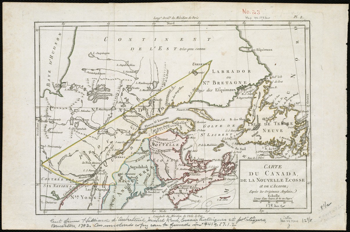
Carte de Canada, de la Nouvelle Ecosse et de l'Acadie : d'après les originaux Anglais
This map is also available in American Revolutionary Geographies Online (ARGO), a collections portal especially built for material relating to the American Revolutionary War Era. Visit ARGO to learn more about this item and explore the historical geography of North America in the late eighteenth century.
Item Information
- Title:
- Carte de Canada, de la Nouvelle Ecosse et de l'Acadie : d'après les originaux Anglais
- Creator:
- Brion de la Tour, Louis.
- Date:
-
[1782]
- Format:
-
Maps/Atlases
- Location:
-
Boston Public Library
Norman B. Leventhal Map Center - Collection (local):
-
Norman B. Leventhal Map Center Collection
- Subjects:
-
Canada--Maps--Early works to 1800
- Places:
-
Canada
- Extent:
- 1 map : col. ; 22 x 33 cm.
- Terms of Use:
-
No known copyright restrictions.
No known restrictions on use.
- Publisher:
-
Brussels :
Hilliard d'Auberteuil
- Scale:
-
Scale [ca. 1:5,900,000].
- Language:
-
French
- Notes:
-
Relief shown pictorially.
Appears in Michel Rene Hilliard d'Auberteuil's Essais historiques et politiques sur la révolution de l'Amerique Septentrionale. Brussels, 1782.
Cataloging, conservation, and digitization made possible in part by The National Endowment for the Humanities: Exploring the human endeavor.
- Notes (date):
-
This date is inferred.
- Identifier:
-
06_01_006165
- Call #:
-
G3400 1782 .B75x
- Barcode:
-
39999059020899


