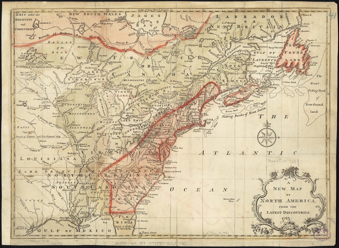
A new map of North America from the latest discoveries
This map is also available in American Revolutionary Geographies Online (ARGO), a collections portal especially built for material relating to the American Revolutionary War Era. Visit ARGO to learn more about this item and explore the historical geography of North America in the late eighteenth century.
Item Information
- Title:
- A new map of North America from the latest discoveries
- Date:
-
1763
- Format:
-
Maps/Atlases
- Location:
-
Boston Public Library
Norman B. Leventhal Map Center - Collection (local):
-
Norman B. Leventhal Map Center Collection
- Subjects:
-
North America--Maps--Early works to 1800
- Places:
-
North America (area)
- Extent:
- 1 map : col. ; 27 x 37 cm.
- Terms of Use:
-
No known copyright restrictions.
No known restrictions on use.
- Publisher:
-
London :
[s.n.]
- Scale:
-
Scale ca. 1:10,000,000.
- Language:
-
English
- Notes:
-
Relief shown pictorially.
From London magazine, v. 32, Jan. 1763.
- Identifier:
-
06_01_006157
- Call #:
-
G3300 1762 .N4
- Barcode:
-
39999059020790
- LCCN:
-
75693984


