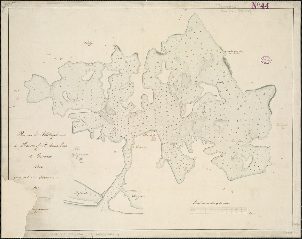
Plan van het Schottegat met de haven, of St. Anna-baai, te Curaçao : 1825
Item Information
- Title:
- Plan van het Schottegat met de haven, of St. Anna-baai, te Curaçao : 1825
- Creator:
- Evertsz, J. B.
- Name on Item:
-
gecopieerd door J.B. Evertsz.
- Date:
-
1827
- Format:
-
Maps/Atlases
Manuscripts
- Location:
-
Boston Public Library
Norman B. Leventhal Map Center - Collection (local):
-
Norman B. Leventhal Map Center Collection
- Subjects:
-
Schottegat (Curaçao)--Maps, Manuscript
Santa Anna Bay (Curaçao)--Maps, Manuscript
- Places:
-
Curacao (territory)Curaçao (island)Santa Anna Bay (channel)
Schottegat
- Extent:
- 1 ms. map : col. ; 42 x 54 cm.
- Terms of Use:
-
No known copyright restrictions.
No known restrictions on use.
- Scale:
-
Scale not given.
- Language:
-
Dutch
- Notes:
-
Manuscript map.
Depths shown by soundings.
- Identifier:
-
06_01_006147
- Call #:
-
G5182.S35 1827 .E94x
- Barcode:
-
39999059020709


