Plans des forts faicts par le Regiment Carignan Salieres sur la Riviere de Richilieu dicte autrement des Iroquois en la Nouvelle France
Item Information
- Title:
- Plans des forts faicts par le Regiment Carignan Salieres sur la Riviere de Richilieu dicte autrement des Iroquois en la Nouvelle France
- Date:
-
[1884?]
- Format:
-
Maps/Atlases
Manuscripts
- Location:
-
Boston Public Library
Norman B. Leventhal Map Center - Collection (local):
-
Norman B. Leventhal Map Center Collection
- Subjects:
-
Iroquois Indians--Maps, Manuscript
Canada--Maps, Manuscript
New France--Maps, Manuscript
New York (State)--Maps, Manuscript
- Places:
-
New York
New France (former administrative division)
Canada
- Extent:
- 1 ms. map ; on sheet 39 x 55 cm.
- Terms of Use:
-
No known copyright restrictions.
No known restrictions on use.
- Scale:
-
Scale not given.
- Language:
-
French
- Notes:
-
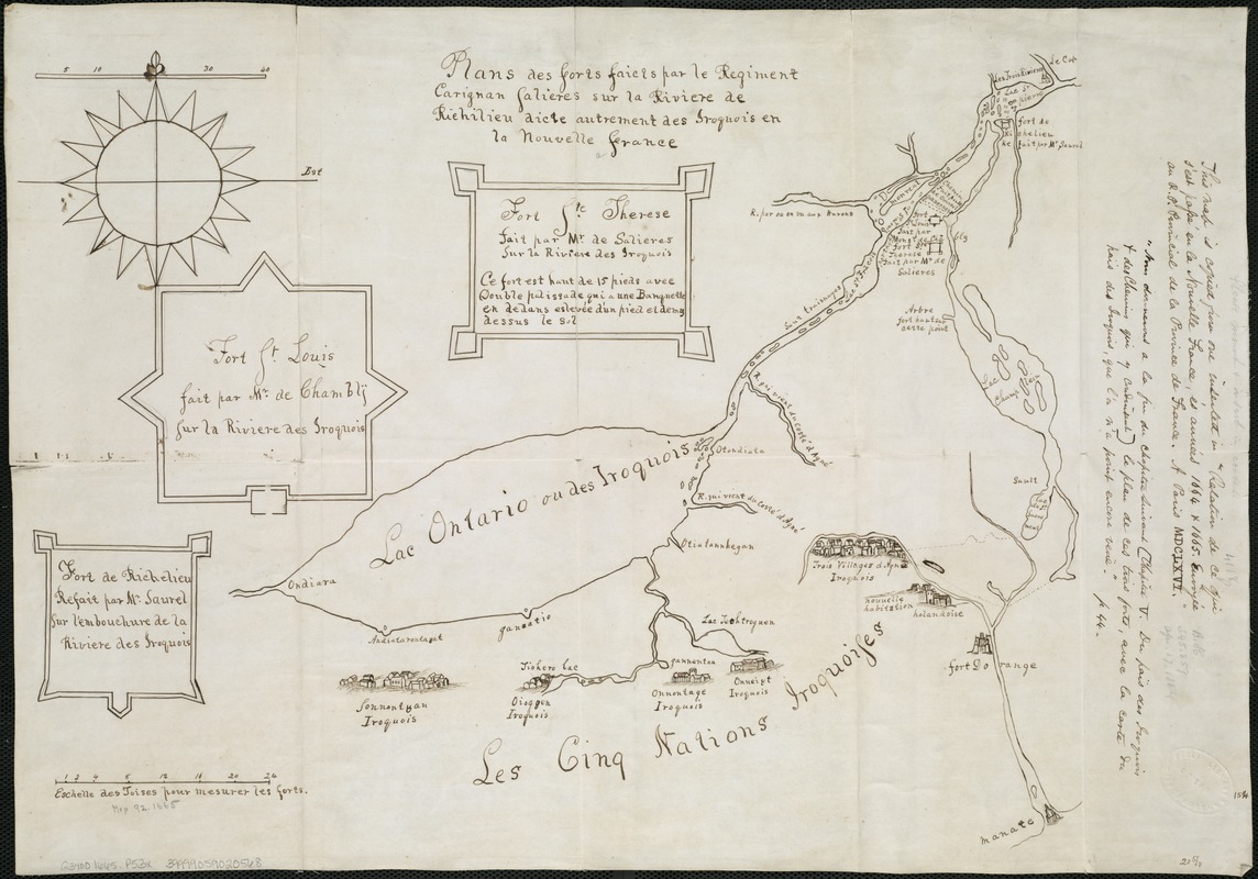
Manuscript map.
Shows the French forts in Canada and the Iroquois villages in New York.
"This map is copied from one inserted in 'Relation de ce qui s'est passe in la Nouvelle France, és années 1664 & 1665. Envoyée au R.P. Provincial de la Province de France. A Paris MDCLXVI."
"Nous [?] a la fin du chapitre suivant [chapitre V. du païs des Iroquois & des Chenins qui y condinsent[?]] le plan de ces trois forts, avec la carte du païs des Iroquois, que l'on n'a point encore ve[v]e."
- Identifier:
-
06_01_006126
- Call #:
-
G3400 1665 .P53x
- Barcode:
-
39999059020568


