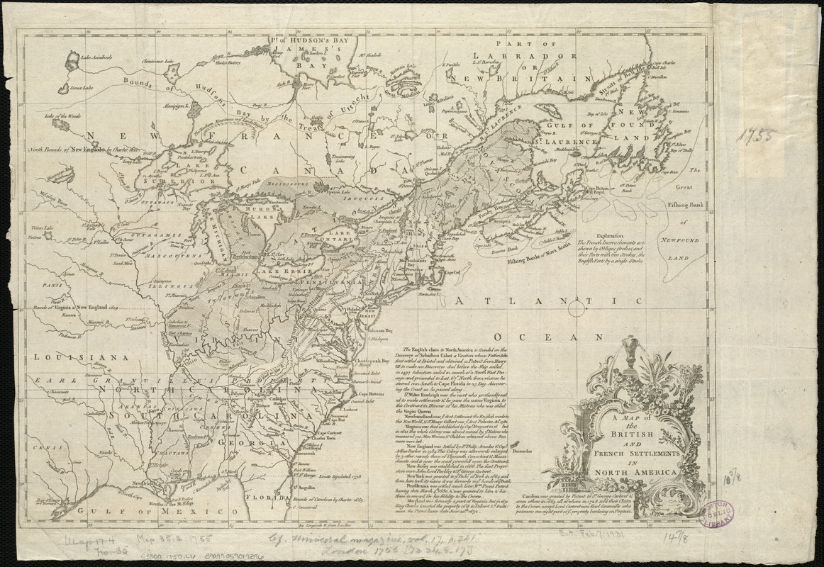
A map of the British and French settlements in North America
Item Information
- Title:
- A map of the British and French settlements in North America
- Creator:
- Lodge, John, d. 1796
- Name on Item:
-
J. Lodge, delin. et sculp.
- Date:
-
[1750?–1759?]
- Format:
-
Maps/Atlases
- Location:
-
Boston Public Library
Norman B. Leventhal Map Center - Collection (local):
-
Norman B. Leventhal Map Center Collection
- Subjects:
-
North America--Maps--Early works to 1800
- Places:
-
North America (area)
- Extent:
- 1 map ; 27 x 38 cm.
- Terms of Use:
-
No known copyright restrictions.
No known restrictions on use.
- Publisher:
-
S.l :
s.n.
- Scale:
-
Scale ca. 1:11,000,000.
- Language:
-
English
- Notes:
-
Covers the eastern half of North America from Hudson Bay to the Gulf of Mexico.
Relief shown pictorially.
Shows boundaries, cities and towns, forts, Indian villages and tribal territory, and "Earl Granville's Property."
"Longitude w. from London."
"The French Incroachments are shewn by Oblique strokes, and their Forts with two Strokes, the English Forts by a single Stroke."
Includes a brief historical note on the English claim to North America and the origins of several colonies.
- Identifier:
-
06_01_006076
- Call #:
-
G3300 1750 .L6
- Barcode:
-
39999059019396
- LCCN:
-
74693889


