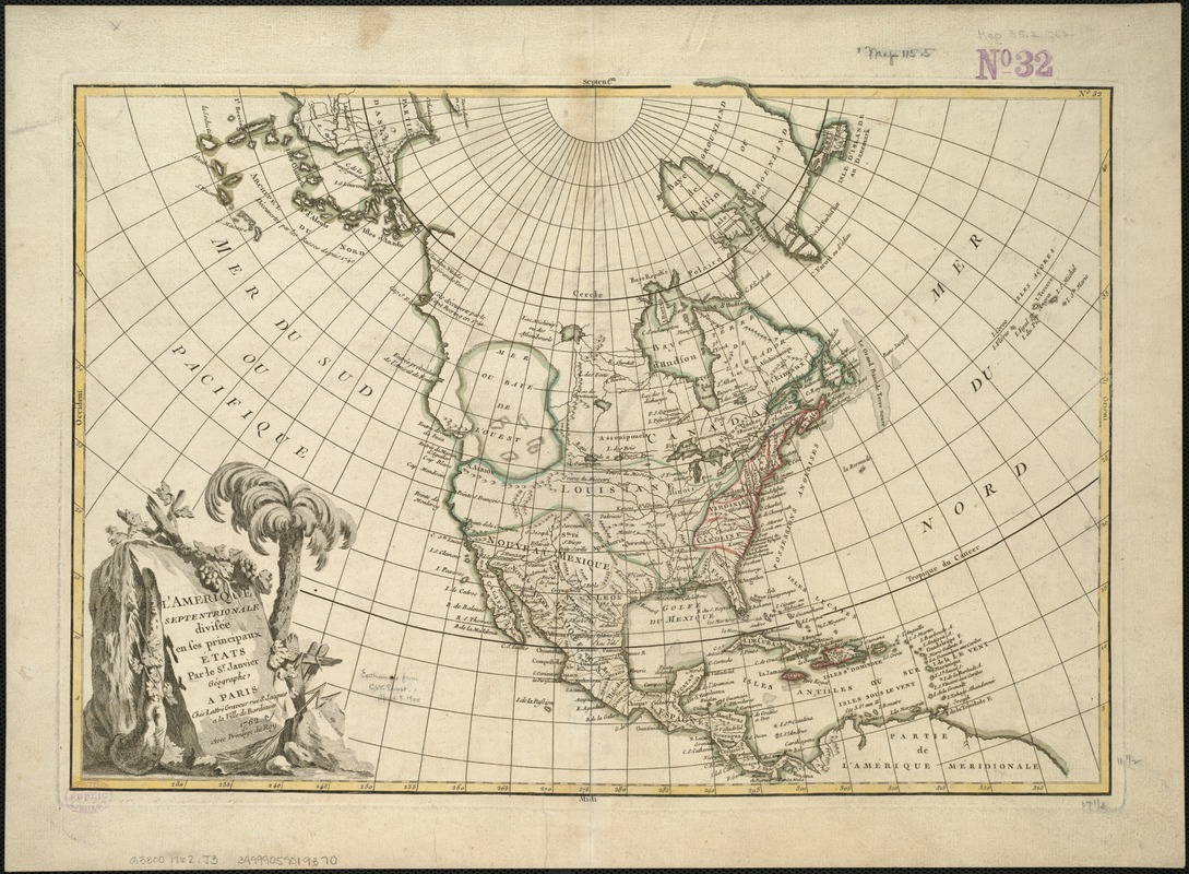
L'Amérique Septentrionale divisée en ses principaux états
This map is also available in American Revolutionary Geographies Online (ARGO), a collections portal especially built for material relating to the American Revolutionary War Era. Visit ARGO to learn more about this item and explore the historical geography of North America in the late eighteenth century.
Item Information
- Title:
- L'Amérique Septentrionale divisée en ses principaux états
- Creator:
- Janvier, Jean Denis.
- Name on Item:
-
par le Sr. Janvier géographe ; Morillier, invenit ; Berthault, sculpcit.
- Date:
-
1762
- Format:
-
Maps/Atlases
- Location:
-
Boston Public Library
Norman B. Leventhal Map Center - Collection (local):
-
Norman B. Leventhal Map Center Collection
- Subjects:
-
North America--Maps--Early works to 1800
- Places:
-
North America (area)
- Extent:
- 1 map : col. ; 31 x 45 cm.
- Terms of Use:
-
No known copyright restrictions.
No known restrictions on use.
- Publisher:
-
A Paris :
Chez Lattré graveur rue St. Jacques a la Ville de Bordeaux
- Scale:
-
Scale 1:22,500,000.
- Language:
-
French
- Notes:
-
Relief shown pictorially.
Cartouche designed by: Morillier.
Cartouche engraved by: Berthault.
In border at upper right: 32.
Appears in Atlas moderne, ou, Collection de cartes sur toutes les parties du globe terrestre. Paris, 1762.
- Identifier:
-
06_01_006072
- Call #:
-
G3300 1762 .J3
- Barcode:
-
39999059019370


