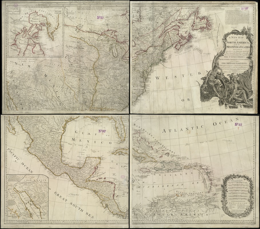
A New map of North America with the West India Islands : divided according to the preliminary articles of peace, signed at Versailles, 20. Jan. 1783, wherein are particularly distinguished the United States and the several provinces, governments & ca. which compose the British Dominions, laid down according to the latest surveys, and corrected from the original materials, of Goverr. Pownall, Membr. of Parliamt
This map is also available in American Revolutionary Geographies Online (ARGO), a collections portal especially built for material relating to the American Revolutionary War Era. Visit ARGO to learn more about this item and explore the historical geography of North America in the late eighteenth century.
Item Information
- Title:
- A New map of North America with the West India Islands : divided according to the preliminary articles of peace, signed at Versailles, 20. Jan. 1783, wherein are particularly distinguished the United States and the several provinces, governments & ca. which compose the British Dominions, laid down according to the latest surveys, and corrected from the original materials, of Goverr. Pownall, Membr. of Parliamt
- Creator:
- Robert Laurie and James Whittle
- Date:
-
1794
- Format:
-
Maps/Atlases
- Location:
-
Boston Public Library
Norman B. Leventhal Map Center - Collection (local):
-
Norman B. Leventhal Map Center Collection
- Subjects:
-
North America--Maps--Early works to 1800
- Places:
-
North America (area)
- Extent:
- 1 map on 4 sheets : hand col. ; 98 x 115 cm., sheets 50 x 58 cm.
- Terms of Use:
-
No known copyright restrictions.
No known restrictions on use.
- Publisher:
-
London :
Laurie & Whittle
- Scale:
-
Scale [ca. 1:5,300,000].
- Language:
-
English
- Notes:
-
Relief shown pictorially.
Inset maps: A particular map of Baffin and Hudson's Bay. Scale [ca. 1:14,000,000] -- The passage by land to California : discovered by Father Francis Kino, a Jesuit between the years 1698 and 1701 ... Scale [ca. 1:5,000,000].
Cataloging, conservation, and digitization made possible in part by The National Endowment for the Humanities: Exploring the human endeavor.
- Identifier:
-
06_01_006061
- Call #:
-
G3300 1794 .R6
- Barcode:
-
39999059019297


