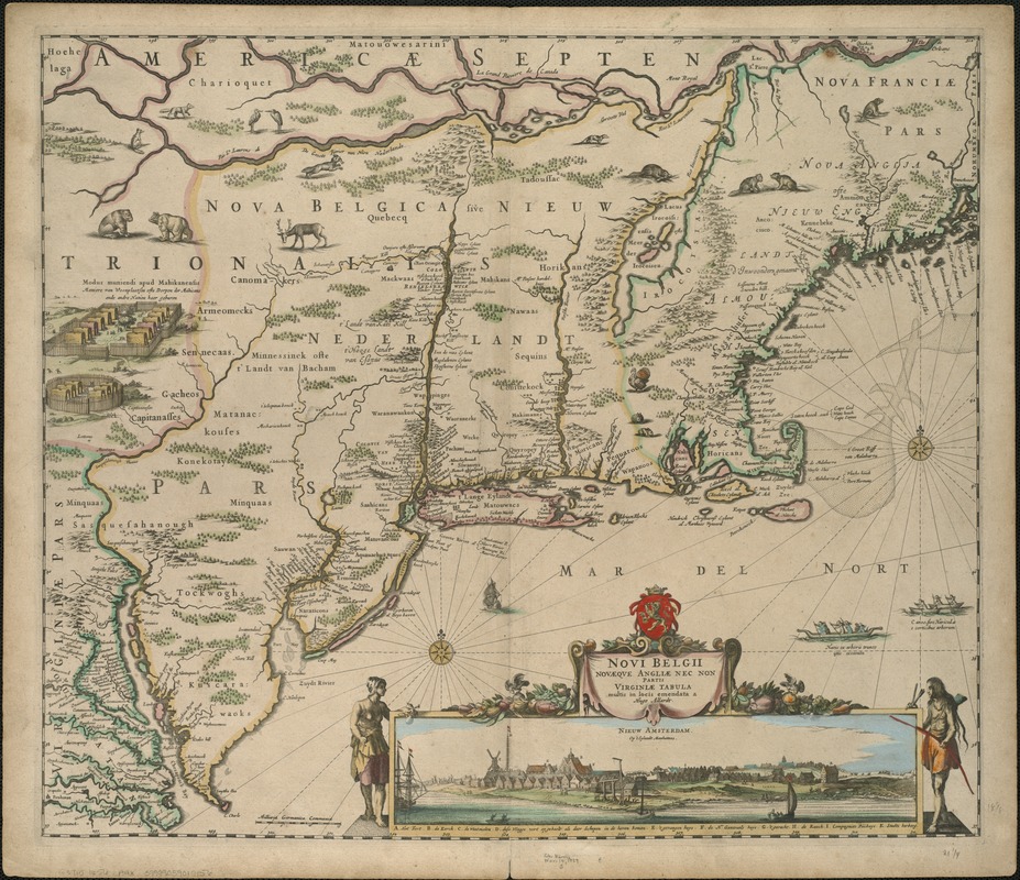
Novi Belgii Novaeqve Angliae nec non partis Virginiae Tabula
Item Information
- Title:
- Novi Belgii Novaeqve Angliae nec non partis Virginiae Tabula
- Creator:
- Allard, Huych, 1625-1691
- Name on Item:
-
multis in locis emendata a Hugo Allardt.
- Date:
-
[1656]
- Format:
-
Maps/Atlases
- Location:
-
Boston Public Library
Norman B. Leventhal Map Center - Collection (local):
-
Norman B. Leventhal Map Center Collection
- Subjects:
-
Northeastern States--Maps--Early works to 1800
New England--Maps--Early works to 1800
Middle Atlantic States--Maps--Early works to 1800
- Places:
-
New England (area)
Northeastern United States (area)
Middle Atlantic (area)
- Extent:
- 1 map : col. ; 46 x 54 cm.
- Terms of Use:
-
No known copyright restrictions.
No known restrictions on use.
- Publisher:
-
Amsterdam :
s.n.
- Scale:
-
Scale [ca. 1:2,300,000].
- Language:
-
Latin
Dutch
- Notes:
-
Relief shown pictorially.
Includes illustration of a Mohican village and N. Visscher's view of Nieuw Amsterdam.
Cataloging, conservation, and digitization made possible in part by The National Endowment for the Humanities: Exploring the human endeavor.
- Notes (date):
-
This date is inferred.
- Identifier:
-
06_01_006028
- Call #:
-
G3715 1656 .A4x
- Barcode:
-
39999059019156


