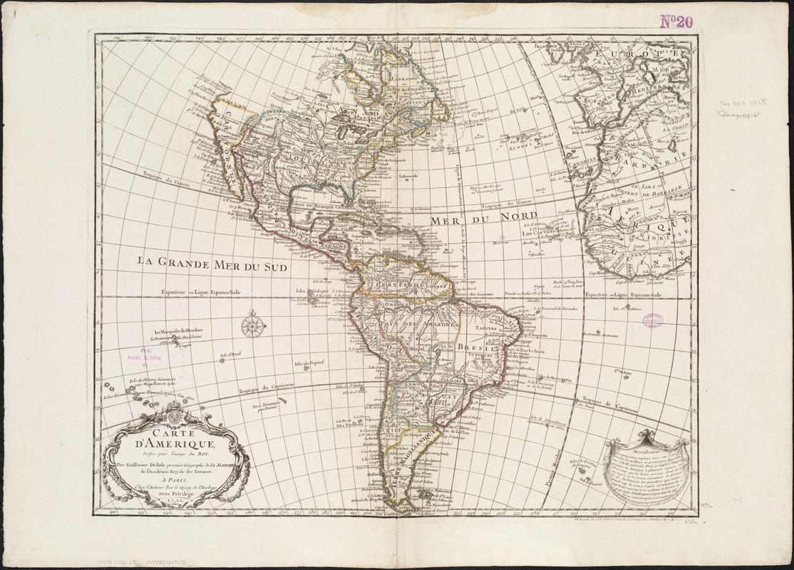
Carte d'Amerique : dressée pour l'usage du Roy
Item Information
- Title:
- Carte d'Amerique : dressée pour l'usage du Roy
- Creator:
- L'Isle, Guillaume de, 1675-1726
- Name on Item:
-
par Guillaume Delisle, premier Geographe de sa Majesté de l'Académie Royale des Sciences.
- Date:
-
1722
- Format:
-
Maps/Atlases
- Location:
-
Boston Public Library
Norman B. Leventhal Map Center - Collection (local):
-
Norman B. Leventhal Map Center Collection
- Subjects:
-
America--Maps--Early works to 1800
Western Hemisphere--Maps--Early works to 1800
- Places:
-
North and Central America
South America
Mesoamerica (area)
North America (area)
South America
America
- Extent:
- 1 map : hand col. ; 49 x 59 cm.
- Terms of Use:
-
No known copyright restrictions.
No known restrictions on use.
- Publisher:
-
Paris :
Chez l'Auteur sur le Quay de l'Horlage
- Scale:
-
Scale [ca. 1:30,000,000]
- Language:
-
French
- Notes:
-
Relief shown pictorially.
Prime meridian: Ferro.
Includes "Avertissement" in draped curtain concerning the projection and scale.
Shows demarcation line of Pope Alexander VI between Spain and Portuguese territories.
In lower right margin: "Ph. Buache P.G.d.R:d.l'A.d.S. Gendre del'Auteur Avec Privilége du 30. Av."
- Identifier:
-
06_01_006011
- Call #:
-
G3290 1722 .L5
- Barcode:
-
39999059019040


