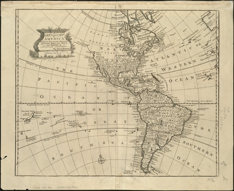
A new general map of America
This map is also available in American Revolutionary Geographies Online (ARGO), a collections portal especially built for material relating to the American Revolutionary War Era. Visit ARGO to learn more about this item and explore the historical geography of North America in the late eighteenth century.
Item Information
- Title:
- A new general map of America
- Creator:
- Bowen, Emanuel, d. 1767
- Name on Item:
-
drawn from several accurate particular maps and charts, and regulated by astronomical observations by Eman. Bowen.
- Date:
-
[1770?–1779?]
- Format:
-
Maps/Atlases
- Location:
-
Boston Public Library
Norman B. Leventhal Map Center - Collection (local):
-
Norman B. Leventhal Map Center Collection
- Subjects:
-
Western Hemisphere--Maps--Early works to 1800
America--Maps--Early works to 1800
- Places:
-
North and Central America
South America
Mesoamerica (area)
North America (area)
South America
America
- Extent:
- 1 map ; 35 x 42 cm.
- Terms of Use:
-
No known copyright restrictions.
No known restrictions on use.
- Publisher:
-
London? :
s.n.
- Scale:
-
Scale not given.
- Language:
-
English
- Notes:
-
Relief shown pictorially.
"No. 51" in lower margin.
- Identifier:
-
06_01_005966
- Call #:
-
G3290 1770 .B6x
- Barcode:
-
39999059018927


