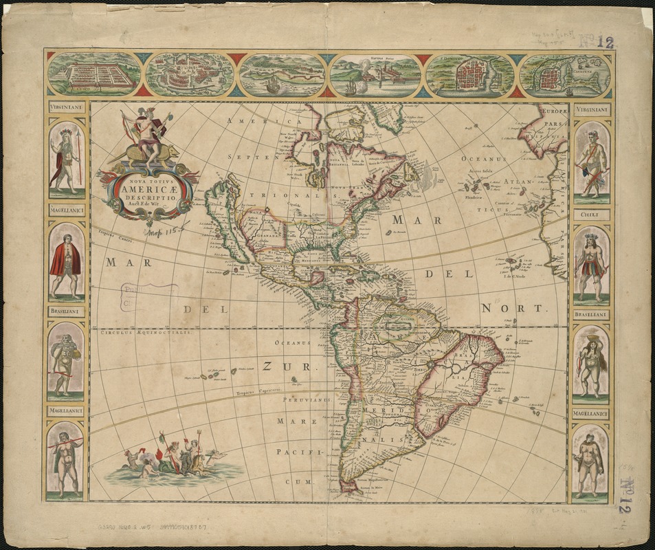
Nova totivs Americae descriptio
Item Information
- Title:
- Nova totivs Americae descriptio
- Title (alt.):
-
Nova totius Americae descriptio
- Creator:
- Wit, Frederik de.
- Name on Item:
-
auct. F. de Wit.
- Date:
-
[1660?–1669?]
- Format:
-
Maps/Atlases
- Location:
-
Boston Public Library
Norman B. Leventhal Map Center - Collection (local):
-
Norman B. Leventhal Map Center Collection
- Subjects:
-
America--Maps--Early works to 1800
Western Hemisphere--Maps--Early works to 1800
- Places:
-
North and Central America
South America
Mesoamerica (area)
North America (area)
South America
America
- Extent:
- 1 map : hand col. ; 39 x 46 cm.
- Terms of Use:
-
No known copyright restrictions.
No known restrictions on use.
- Publisher:
-
Amsterdam :
F. de Wit
- Scale:
-
Scale [ca. 1:43,000,000].
- Language:
-
Latin
- Notes:
-
Relief shown pictorially.
State 3, 1660, according to McLaughlin (date erased from cartouche and with "2" or "3" in top right). State 2, c. 1666, according to Burden.
Includes side borders of indigenous people and a top border of bird's-eye views of principal towns.
- Identifier:
-
06_01_005941
- Call #:
-
G3290 1660.2 .W5
- Barcode:
-
39999059018737


