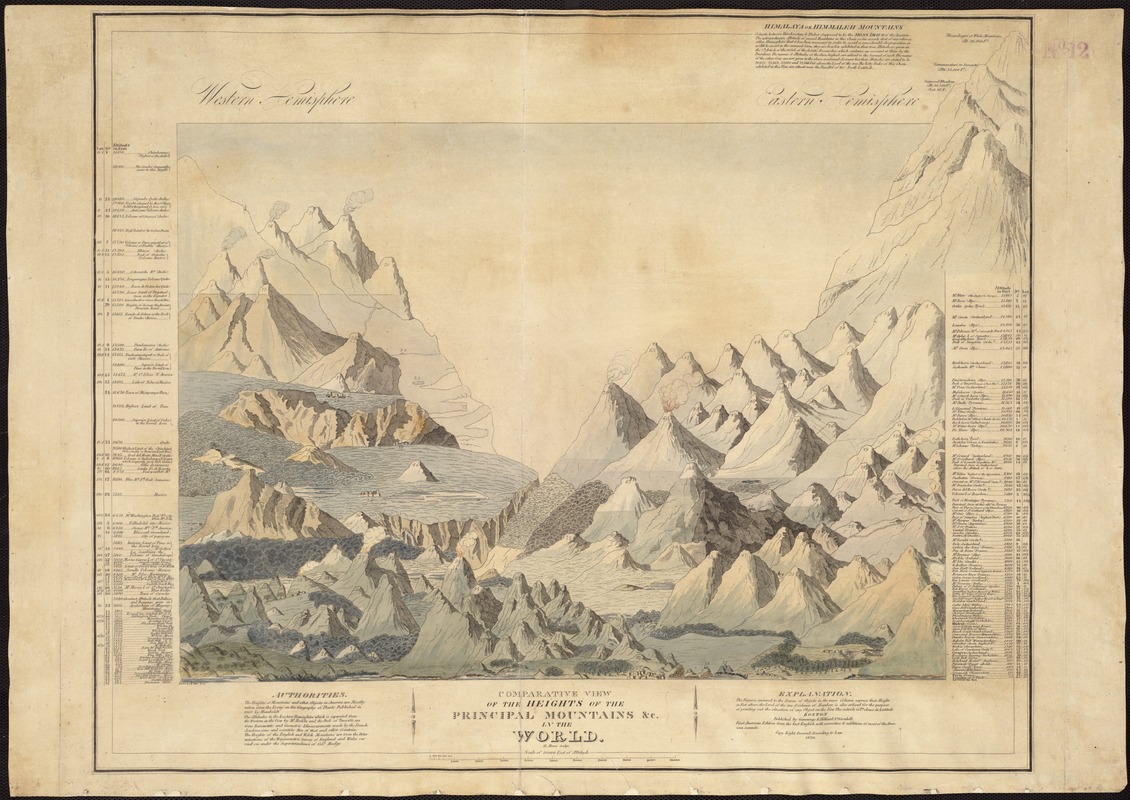
Comparative view of the heights of the principal mountains &c. in the world
Item Information
- Title:
- Comparative view of the heights of the principal mountains &c. in the world
- Name on Item:
-
H. Morse, sculpt.
- Date:
-
1820
- Format:
-
Maps/Atlases
- Location:
-
Boston Public Library
Norman B. Leventhal Map Center - Collection (local):
-
Norman B. Leventhal Map Center Collection
- Subjects:
-
Mountains--Maps
World maps
- Places:
-
World
- Extent:
- 1 map : col. ; 50 x 62 cm.
- Terms of Use:
-
No known copyright restrictions.
No known restrictions on use.
- Publisher:
-
Boston :
Cummings and Hilliard
- Edition:
- First American ed.
- Scale:
-
Scale ca. 1:18,450.
- Language:
-
English
- Notes:
-
Relief shown pictorially.
"First American edition from the last English, with corrections & additions of most of the American summits.
- Identifier:
-
06_01_005926
- Call #:
-
G3201.C1 1820 .C6
- Barcode:
-
39999059018604


