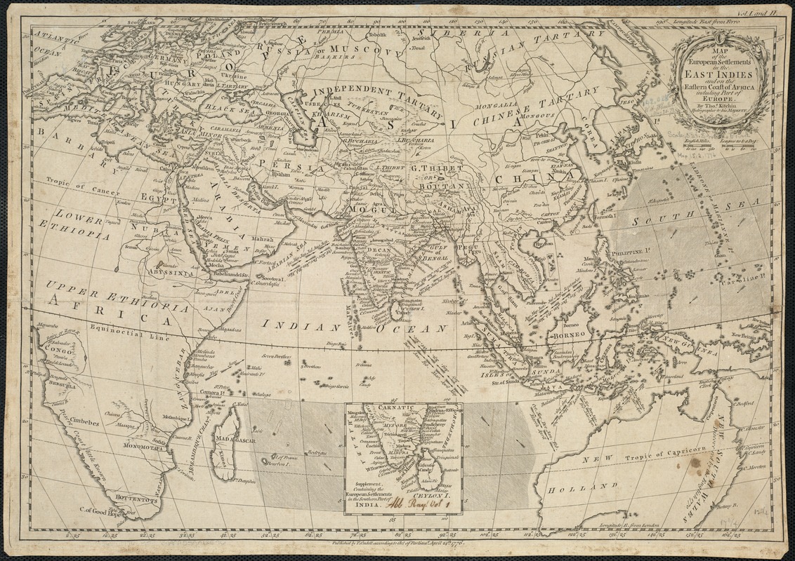
Map of the European settlements in the East Indies and on the eastern coast of Africa including part of Europe
Item Information
- Title:
- Map of the European settlements in the East Indies and on the eastern coast of Africa including part of Europe
- Creator:
- Kitchin, Thomas, d. 1784
- Name on Item:
-
by Thos. Kitchin.
- Date:
-
1776
- Format:
-
Maps/Atlases
- Location:
-
Boston Public Library
Norman B. Leventhal Map Center - Collection (local):
-
Norman B. Leventhal Map Center Collection
- Subjects:
-
Eastern Hemisphere--Maps--Early works to 1800
Europe--Colonies--Maps--Early works to 1800
1776
- Places:
-
Europe
Asia
Africa
Oceania
Europe
Africa
Asia
Oceania
- Extent:
- 1 map ; 32 x 46 cm.
- Terms of Use:
-
No known copyright restrictions.
No known restrictions on use.
- Publisher:
-
[London] :
Published by T. Cadell according to Act of Parliamt
- Scale:
-
Scale [ca. 1:33 000 000].
- Language:
-
English
- Notes:
-
Map of the Eastern hemisphere showing the direction of prevailing winds and trade routes.
Relief shown pictorially.
Inset: Supplement, containing the European settlements in the southern part of India.
Prime meridians: Ferro and London.
Cataloging, conservation, and digitization made possible in part by The National Endowment for the Humanities: Exploring the human endeavor.
- Identifier:
-
06_01_005925
- Call #:
-
G5670 1776 .K5
- Barcode:
-
39999059018596