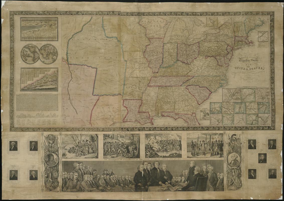
Phelps & Ensign's travellers' guide, and map of the United States, containing the roads, distances, steam boat and canal routes &c
Item Information
- Title:
- Phelps & Ensign's travellers' guide, and map of the United States, containing the roads, distances, steam boat and canal routes &c
- Title (alt.):
-
Travellers' guide, and map of the United States
Phelps and Ensign's travellers' guide, and map of the United States
- Creator:
- Phelps & Ensign
- Name on Item:
-
engraved on steel by J. Wells.
- Date:
-
1840
- Format:
-
Maps/Atlases
- Location:
-
Boston Public Library
Norman B. Leventhal Map Center - Collection (local):
-
Norman B. Leventhal Map Center Collection
- Subjects:
-
Transportation--United States--Maps
United States--Maps
United States--Distances, etc--Maps
- Places:
-
- Extent:
- 1 map : hand col. ; 41 x 77 cm.
- Terms of Use:
-
No known copyright restrictions.
No known restrictions on use.
- Publisher:
-
New York :
Published by Phelps & Ensign
- Scale:
-
Scale [ca. 1:4,750,000].
- Language:
-
English
- Notes:
-
Relief shown by hachures.
Prime meridian: Washington.
Distances from point to point shown on roads.
Map within decorative borders.
Contains numerous ill. and vignettes.
Submaps -- 1. A comparative view of the chief rivers in the world -- 2. The world -- 3. A comparative view of the principal mountains in the world -- 4. North part of Maine -- 5. South part of Florida -- 6. Vicinity of Baltimore -- 7. Vicinity of Charleston -- 8. Vicinity of New York -- 9. Vicinity of New Orleans -- 10. Vicinity of Pittsburg -- 11. Vicinity of Mobile -- 12. Vicinity of Chicago -- 13. Vicinity of Philadelphia -- 14. Vicinity of Cincinnati -- 15. Vicinity of Detroit -- 16. Vicinity of Boston -- 17. Vicinity of St. Louis -- 18. Vicinity of Washington.
- Identifier:
-
06_01_005898
- Call #:
-
G3700 1840 .P5
- Barcode:
-
39999058997394


