A new map of the whole world with the trade winds according to ye latest and most exact observations
Item Information
- Title:
- A new map of the whole world with the trade winds according to ye latest and most exact observations
- Creator:
- Moll, Herman, d. 1732
- Publisher:
- Bowles, John, 1701-1779
- Publisher:
- Bowles, Thomas, 1694-1773
- Name on Item:
-
by H. Moll.
- Date:
-
[1732?]
- Format:
-
Maps/Atlases
- Location:
-
Boston Public Library
Norman B. Leventhal Map Center - Collection (local):
-
Norman B. Leventhal Map Center Collection
- Subjects:
-
World maps--Early works to 1800
- Places:
-
World
- Extent:
- 1 map : col. ; 2 hemispheres each 13 cm. in diameter, on sheet 25 x 36 cm.
- Terms of Use:
-
No known copyright restrictions.
No known restrictions on use.
- Publisher:
-
[London] :
Printed for Tho. Bowles ... and John Bowles ... London
- Scale:
-
Scale [ca. 1:200,000,000].
- Language:
-
English
- Notes:
-
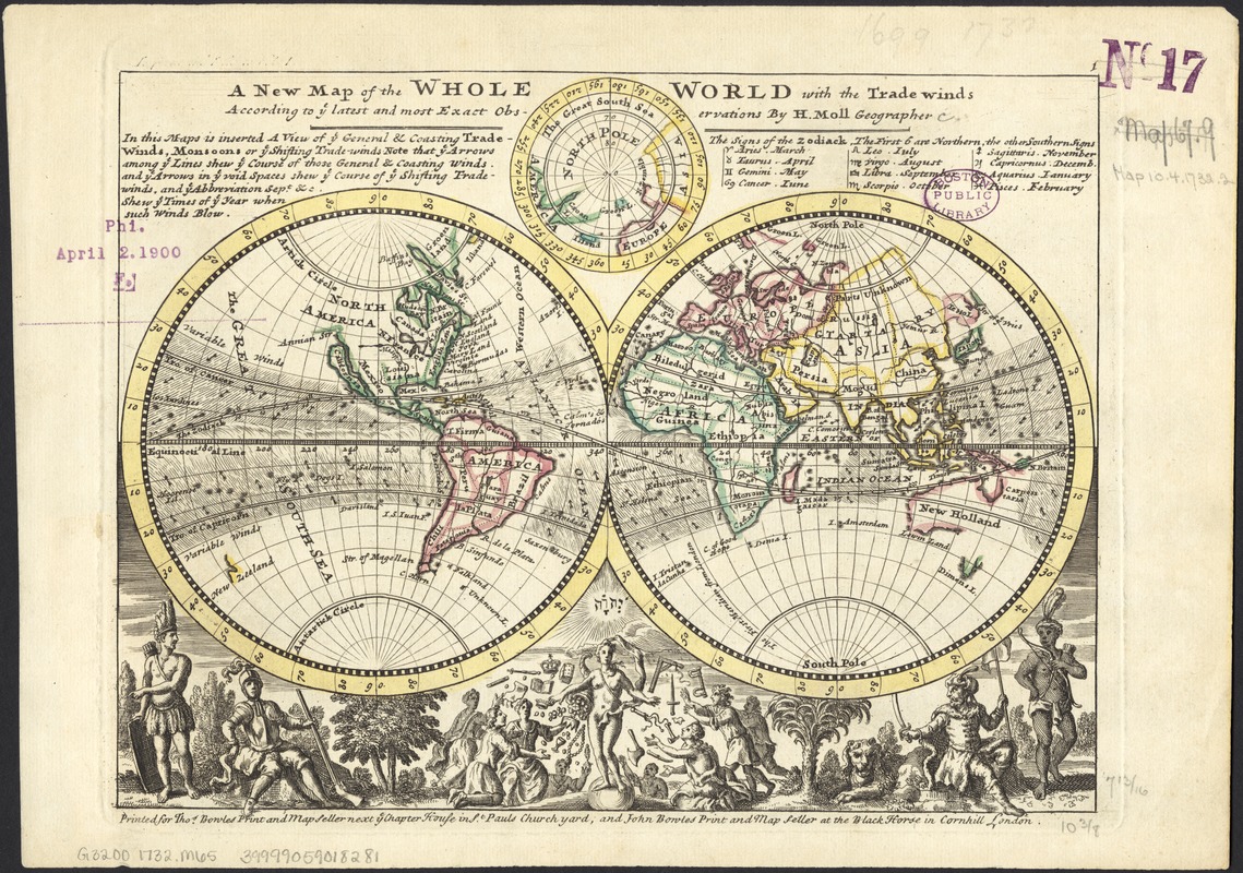
Inset map of the North Pole.
Numbered 1.
List of signs of the zodiac ; note about the trade winds.
Illustrated below hemispheres with people, and goddess distributing gifts.
Trade winds shown by shading and arrows.
London meridian.
Appears in Moll's Atlas Minor. London : Thomas Bowles and John Bowles, 1732 or 1736.
The World, shown as eastern and western hemispheres, with inset showing the Arctic.
- Identifier:
-
06_01_005889
- Call #:
-
G3200 1732 .M65
- Barcode:
-
39999059018281


