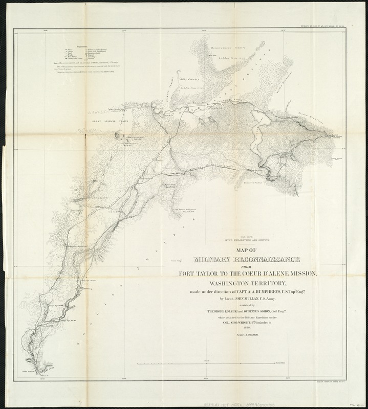
Map of military reconnaissance from Fort Taylor to the Coeur d'Alene mission, Washington Territory
Item Information
- Title:
- Map of military reconnaissance from Fort Taylor to the Coeur d'Alene mission, Washington Territory
- Creator:
- Mullan, John, 1830-1909
- Name on Item:
-
made under the direction of Capt. A.A. Humphreys, U.S. Topl. Engrs., by Lieut. John Mullan, U.S. Army, assisted by Theodore Kolecki and Gustavus Sohon, Civil Engrs., while attached to the military expedition under Col. Geo. Wright, 9th Infantry, in 1858.
- Date:
-
1858
- Format:
-
Maps/Atlases
- Location:
-
Boston Public Library
Norman B. Leventhal Map Center - Collection (local):
-
Norman B. Leventhal Map Center Collection
- Subjects:
-
Military maps
Military reconnaissance--Maps
Military roads--Washington (State)--Maps
Military roads--Idaho--Maps
Mullan Road--Maps
Washington (State)--Maps
Idaho--Maps
- Places:
-
Idaho
Washington
- Extent:
- 1 map ; 54 x 51 cm.
- Terms of Use:
-
No known copyright restrictions.
No known restrictions on use.
- Publisher:
-
Washington, D.C :
War Dept., Office [of] Explorations and Surveys
- Scale:
-
Scale 1:300,000.
- Language:
-
English
- Notes:
-
Relief shown by form lines.
Shows approximate location of military road constructed 1859 to 1862.
Also shows farms, camps, trails, bridges, vegetation types, rapids, rock outcrops, landings, and locations of battles.
"Senate Ex. Doc. No. 43-47th Cong. 3d. Sess."
- Identifier:
-
06_01_005752
- Call #:
-
G4241.R1 1858 .M85x
- Barcode:
-
39999059017010