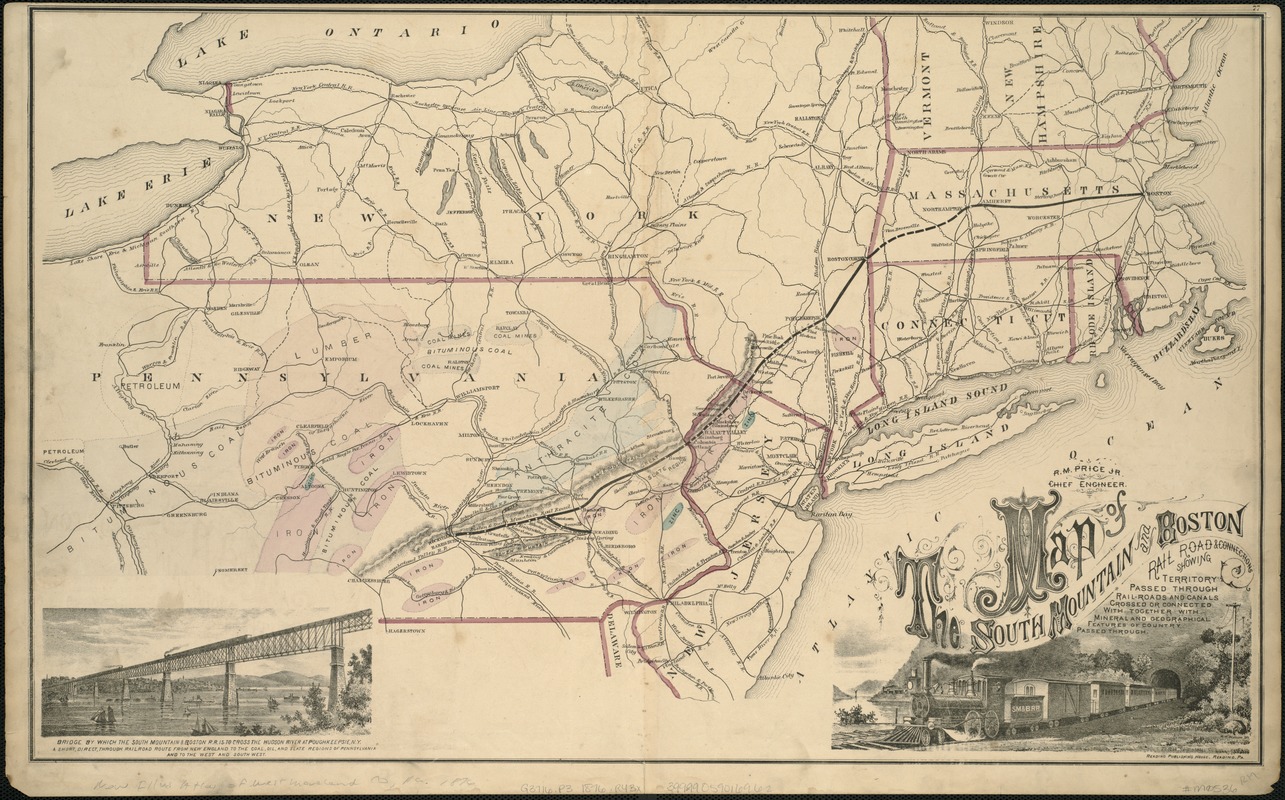
Map of the South Mountain and Boston Railroad & connections showing territory passed through, rail-roads and canals crossed or connected with, together with mineral and geographical features of country passed through
Item Information
- Title:
- Map of the South Mountain and Boston Railroad & connections showing territory passed through, rail-roads and canals crossed or connected with, together with mineral and geographical features of country passed through
- Creator:
- Reading Publishing House (Reading, Pa.)
- Name on Item:
-
R.M. Price, chief engineer.
- Date:
-
[1876]
- Format:
-
Maps/Atlases
- Location:
-
Boston Public Library
Norman B. Leventhal Map Center - Collection (local):
-
Norman B. Leventhal Map Center Collection
- Subjects:
-
Railroads--New England--Maps
Railroads--Middle Atlantic States--Maps
New England--Maps
Middle Atlantic States--Maps
- Places:
-
New England (area)
Middle Atlantic (area)
- Extent:
- 1 map : col. ; 41 x 67 cm.
- Terms of Use:
-
No known copyright restrictions.
No known restrictions on use.
- Publisher:
-
Reading, Pa :
Reading Publishing House
- Scale:
-
Scale not given.
- Language:
-
English
- Notes:
-
Relief shown by hachures.
Inset: Bridge by which the South Mountain & Boston R.R. is to cross the Hudson River at Poughkeepsie, N.Y.
Shows coal deposits, iron deposits and other mineralogical features.
- Notes (date):
-
This date is inferred.
- Identifier:
-
06_01_005750
- Call #:
-
G3716.P3 1876 .R43
- Barcode:
-
39999059016962


