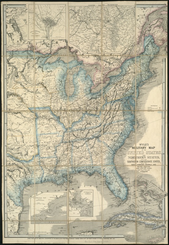
Wyld's military map of the United States, the northern states, and the southern Confederate states : with the forts, harbours, arsenals, and military positions
Item Information
- Title:
- Wyld's military map of the United States, the northern states, and the southern Confederate states : with the forts, harbours, arsenals, and military positions
- Cover title :
- Military map of the United States
- Title (alt.) :
- Wyld's new map of the United States
- Creator:
- Wyld, James, 1812-1887
- Name on Item:
-
James Wyld.
- Date:
-
1861
- Format:
-
Maps/Atlases
- Location:
-
Boston Public Library
Norman B. Leventhal Map Center - Collection (local):
-
Norman B. Leventhal Map Center Collection
- Subjects:
-
United States--Maps
United States--History--Civil War, 1861-1865--Maps
- Places:
-
- Extent:
- 1 map : hand col. ; 88 x 60 cm. fold. in cover 21 x 13 cm.
- Terms of Use:
-
No known copyright restrictions.
No known restrictions on use.
- Publisher:
-
London :
Wyld
- Scale:
-
Scale [ca. 1:4,500,000]
- Language:
-
English
- Notes:
-
Relief shown by hachures.
Insets: City of Washington and District of Columbia; Country round Washington; Pensacola Bay and its fortifications; Charleston and the harbour.
First edition.
- Identifier:
-
06_01_005745
- Call #:
-
G3701.S5 1861 .W95
- Barcode:
-
39999059016913


