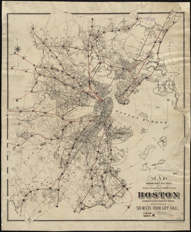
Map showing horse rail roads and the surface steam roads with 104 stations in and around Boston : including 91 surface steam r.r. stations within a radius of six miles from city hall
Item Information
- Title:
- Map showing horse rail roads and the surface steam roads with 104 stations in and around Boston : including 91 surface steam r.r. stations within a radius of six miles from city hall
- Name on Item:
-
[compiled by Fred Pope].
- Date:
-
[1876]
- Format:
-
Maps/Atlases
- Location:
-
Boston Public Library
Norman B. Leventhal Map Center - Collection (local):
-
Norman B. Leventhal Map Center Collection
- Subjects:
-
Railroads--Massachusetts--Boston--Maps
Street-railroads--Massachusetts--Boston--Maps
Horse railroads--Massachusetts--Boston--Maps
Urban transportation--Massachusetts--Boston--Maps
Boston (Mass.)--Maps
Boston Metropolitan Area (Mass.)--Maps
- Places:
-
Suffolk (county)Boston
- Extent:
- 1 map ; 74 x 63 cm.
- Terms of Use:
-
No known copyright restrictions.
No known restrictions on use.
- Publisher:
-
Boston :
J.H. Bufford's Sons
- Scale:
-
Scale not given.
- Language:
-
English
- Notes:
-
Shows lines and stations in color.
- Notes (date):
-
This date is inferred.
- Identifier:
-
06_01_005575
- Call #:
-
G3764.B6P33 1876 .M3x
- Barcode:
-
39999059015212


