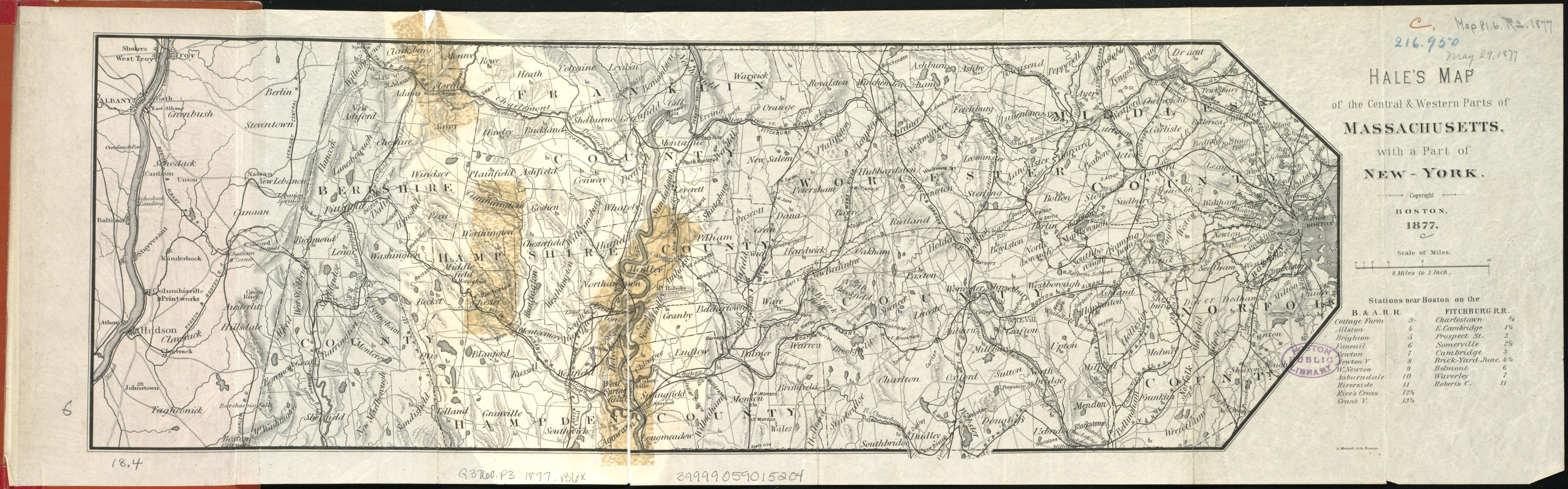
Hale's map of the central & western parts of Massachusetts, with a part of New-York
Item Information
- Title:
- Hale's map of the central & western parts of Massachusetts, with a part of New-York
- Cover title :
- Hale's Map of the Boston & Albany Rail-Road
- Creator:
- Boston and Albany Railroad Co
- Date:
-
1877
- Format:
-
Maps/Atlases
- Location:
-
Boston Public Library
Norman B. Leventhal Map Center - Collection (local):
-
Norman B. Leventhal Map Center Collection
- Subjects:
-
Boston and Albany Railroad Co.--Maps
Railroads--Massachusetts--Maps
Railroads--New York (State)--Maps
Massachusetts--Maps
New York (State)--Maps
- Places:
-
Massachusetts
New York
- Extent:
- 1 map ; 16 x 47 cm.
- Terms of Use:
-
No known copyright restrictions.
No known restrictions on use.
- Publisher:
-
Boston :
[A. Williams & Co.]
- Scale:
-
Scale 1:506,880.
- Language:
-
English
- Notes:
-
Relief shown by hachures.
- Identifier:
-
06_01_005574
- Call #:
-
G3760.P3 1877 .B6
- Barcode:
-
39999059015204


