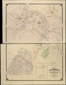
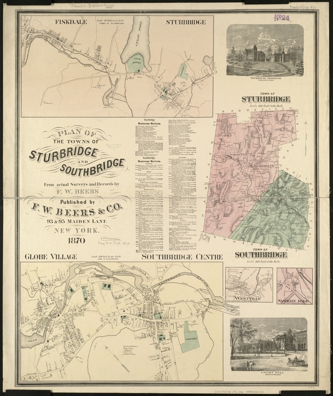
Plan of the towns of Sturbridge and Southbridge : from actual surveys and records
Item Information
- Title:
- Plan of the towns of Sturbridge and Southbridge : from actual surveys and records
- Creator:
- Beers, F. W. (Frederick W.)
- Name on Item:
-
by F.W. Beers.
- Date:
-
1870
- Format:
-
Maps/Atlases
- Location:
-
Boston Public Library
Norman B. Leventhal Map Center - Collection (local):
-
Norman B. Leventhal Map Center Collection
- Subjects:
-
Real property--Massachusetts--Sturbridge--Maps
Landowners--Massachusetts--Sturbridge--Maps
Real property--Massachusetts--Southbridge--Maps
Landowners--Massachusetts--Southbridge--Maps
Sturbridge (Mass. : Town)--Maps
Southbridge (Mass.)--Maps
- Places:
-
Worcester (county)Southbridge
Worcester (county)Sturbridge
- Extent:
- 1 map : col. ; 79 x 63 cm.
- Terms of Use:
-
No known copyright restrictions.
No known restrictions on use.
- Publisher:
-
New York :
F.W. Beers
- Scale:
-
Scale 1:39,600.
- Language:
-
English
- Notes:
-
Includes list of business notices.
Insets: Globe Village and Southbridge Centre, Westville, Sanders Dale, Fiskdale and Sturbridge, and two ill.
- Identifier:
-
06_01_005464
- Call #:
-
G3764.S83G46 1870 .B4x
- Barcode:
-
39999059014413