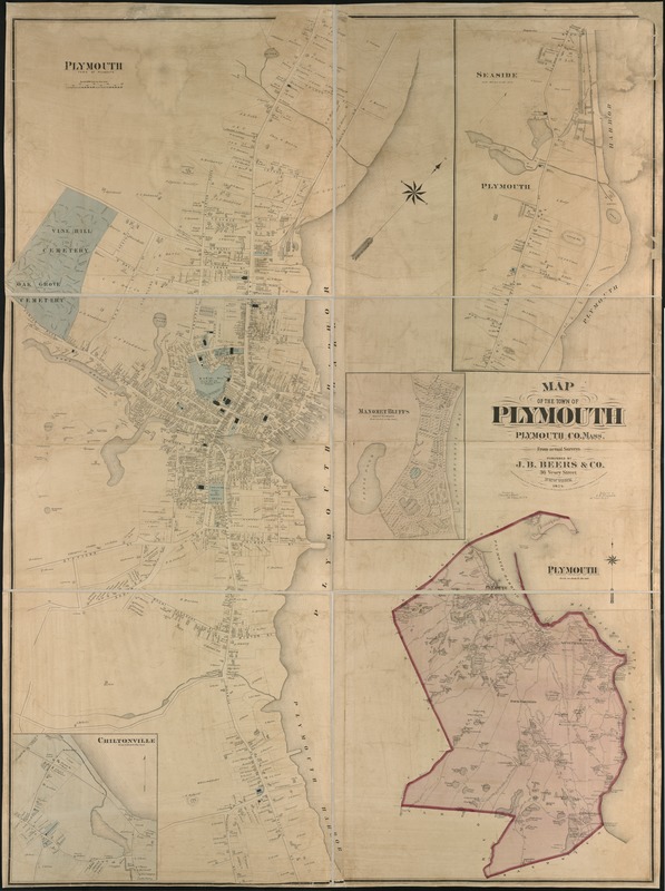
Map of the town of Plymouth : Plymouth Co. Mass. : from actual surveys
Item Information
- Title:
- Map of the town of Plymouth : Plymouth Co. Mass. : from actual surveys
- Creator:
- J.B. Beers & Co
- Name on Item:
-
engraved by L.E. Neuman.
- Date:
-
1874
- Format:
-
Maps/Atlases
- Location:
-
Boston Public Library
Norman B. Leventhal Map Center - Collection (local):
-
Norman B. Leventhal Map Center Collection
- Subjects:
-
Landowners--Massachusetts--Plymouth (Town)--Maps
Real property--Massachusetts--Plymouth (Town)--Maps
Plymouth (Mass. : Town)--Maps
- Places:
-
Plymouth (county)Plymouth
- Extent:
- 1 map : col. ; 156 x 118 cm.
- Terms of Use:
-
No known copyright restrictions.
No known restrictions on use.
- Publisher:
-
New York :
J.B. Beers & Co.
- Scale:
-
Scale 1:2,400.
- Language:
-
English
- Notes:
-
Relief shown by hachures.
Insets: Chiltonville, Manomet Bluffs, Seaside and Plymouth.
- Identifier:
-
06_01_005423
- Call #:
-
G3764.P72G46 1874 .J3x
- Barcode:
-
39999059014173