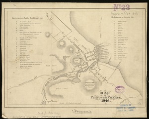
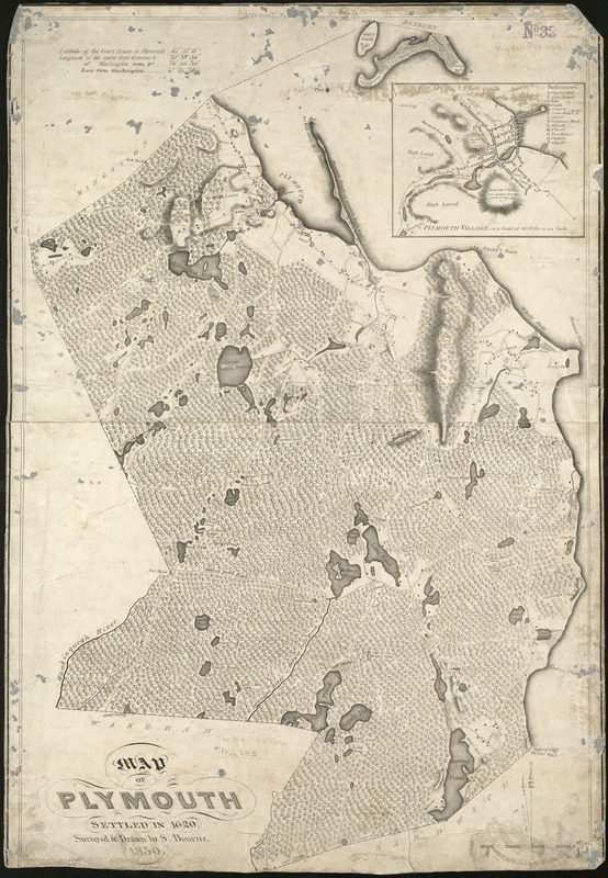
Map of Plymouth settled in 1620
Item Information
- Title:
- Map of Plymouth settled in 1620
- Creator:
- Bourne, S.
- Name on Item:
-
surveyed and drawn by S. Bourne.
- Date:
-
[1830]
- Format:
-
Maps/Atlases
- Location:
-
Boston Public Library
Norman B. Leventhal Map Center - Collection (local):
-
Norman B. Leventhal Map Center Collection
- Subjects:
-
Plymouth (Mass. : Town)--Maps
- Places:
-
Plymouth (county)Plymouth
- Extent:
- 1 map ; 83 x 55 cm.
- Terms of Use:
-
No known copyright restrictions.
No known restrictions on use.
- Publisher:
-
Boston :
Pendleton's Lith.
- Scale:
-
Scale 1:31,680.
- Language:
-
English
- Notes:
-
Relief shown by hachures.
Inset: Plymouth Village, on a scale of 50 poles to an inch.
- Notes (date):
-
This date is inferred.
- Identifier:
-
06_01_005422
- Call #:
-
G3764.P72 1830 .B68x
- Barcode:
-
39999059014157