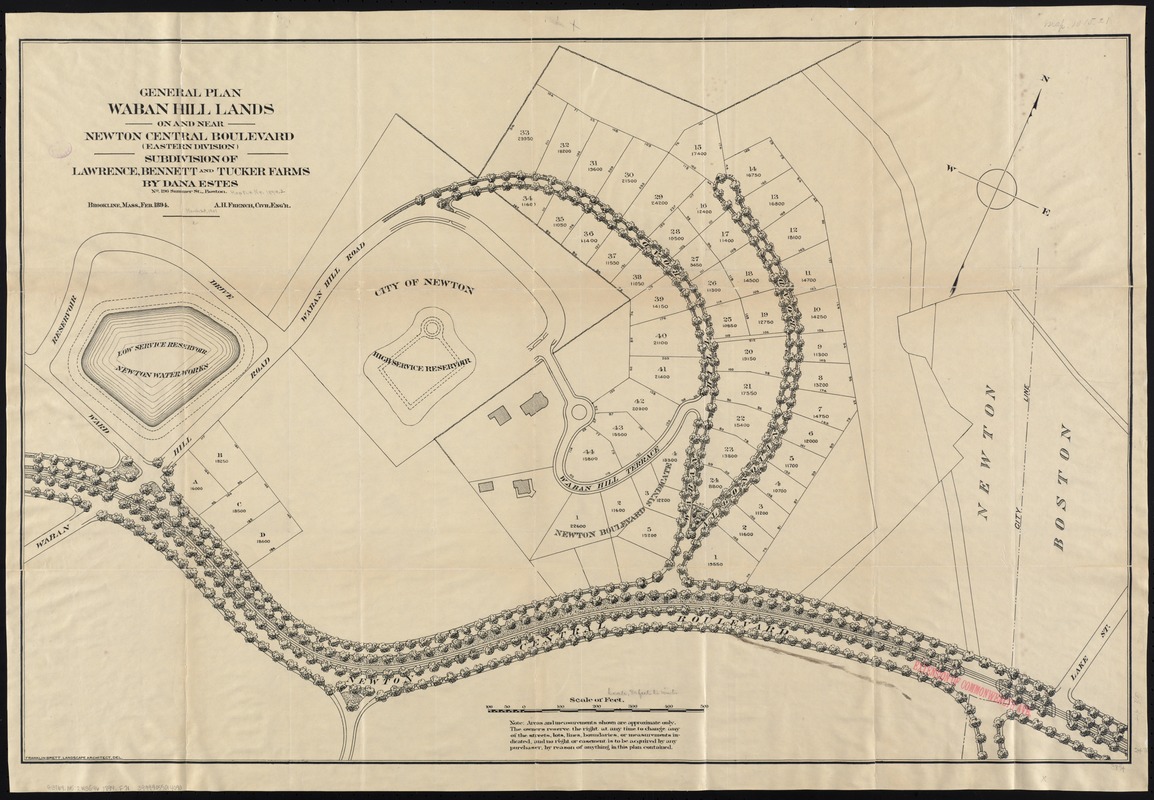
General plan Waban Hill lands on and near Newton Central Boulevard (eastern division) : subdivision of Lawrence, Bennett and Tucker farms by Dana Estes
Item Information
- Title:
- General plan Waban Hill lands on and near Newton Central Boulevard (eastern division) : subdivision of Lawrence, Bennett and Tucker farms by Dana Estes
- Cover title :
- Newton Heights overlooking Chesnut Hill Reservoir
- Cover title :
- General plan of Waban Hill lands, on and near Newton Central Boulevard, (eastern division.)
- Creator:
- French, A. H., civil engineer
- Name on Item:
-
A.H. French, civil engr. ; Franklin Brett del.
- Date:
-
[1894]
- Format:
-
Maps/Atlases
- Location:
-
Boston Public Library
Norman B. Leventhal Map Center - Collection (local):
-
Norman B. Leventhal Map Center Collection
- Subjects:
-
Real property--Massachusetts--Newton--Maps
Landowners--Massachusetts--Newton--Maps
Newton (Mass.)--Maps
Waban (Newton, Mass.)--Maps
Waban (Newton, Mass.)
- Places:
-
Middlesex (county)Newton
Middlesex (county)Waban
- Extent:
- 1 map ; 64 x 97 cm.
- Terms of Use:
-
No known copyright restrictions.
No known restrictions on use.
- Publisher:
-
S.l :
s.n.
- Scale:
-
Scale 1:960.
- Language:
-
English
- Notes:
-
Oriented with north toward the upper right.
- Notes (date):
-
This date is inferred.
- Identifier:
-
06_01_005416
- Call #:
-
G3764.N5:2W3G46 1894 .F7x
- Barcode:
-
39999059014090


