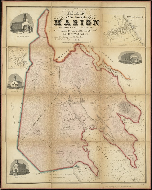
Map of the town of Marion, Plymouth County, Mass : surveyed by order of the town
Item Information
- Title:
- Map of the town of Marion, Plymouth County, Mass : surveyed by order of the town
- Creator:
- Walling, Henry Francis, 1825-1888
- Name on Item:
-
by H.F. Walling.
- Date:
-
1855
- Format:
-
Maps/Atlases
- Location:
-
Boston Public Library
Norman B. Leventhal Map Center - Collection (local):
-
Norman B. Leventhal Map Center Collection
- Subjects:
-
Real property--Massachusetts--Marion (Town)--Maps
Landowners--Massachusetts--Marion (Town)--Maps
Marion (Mass. : Town)--Maps
- Places:
-
Plymouth (county)Marion
- Extent:
- 1 map : hand col. ; 82 x 65 cm.
- Terms of Use:
-
No known copyright restrictions.
No known restrictions on use.
- Publisher:
-
S.l :
[s.n.]
- Scale:
-
Scale [1:12,672].
- Language:
-
English
- Notes:
-
Relief shown by hachures. Depths shown by soundings and contours.
Shows buildings with names of property owners.
Insets: Sippican Village. Scale [1:4,950] -- Old Landing. Scale [1:4,950].
Includes 4 vignettes of town buildings.
- Identifier:
-
06_01_005383
- Call #:
-
G3764.M32 1855 .W3
- Barcode:
-
39999059013589


