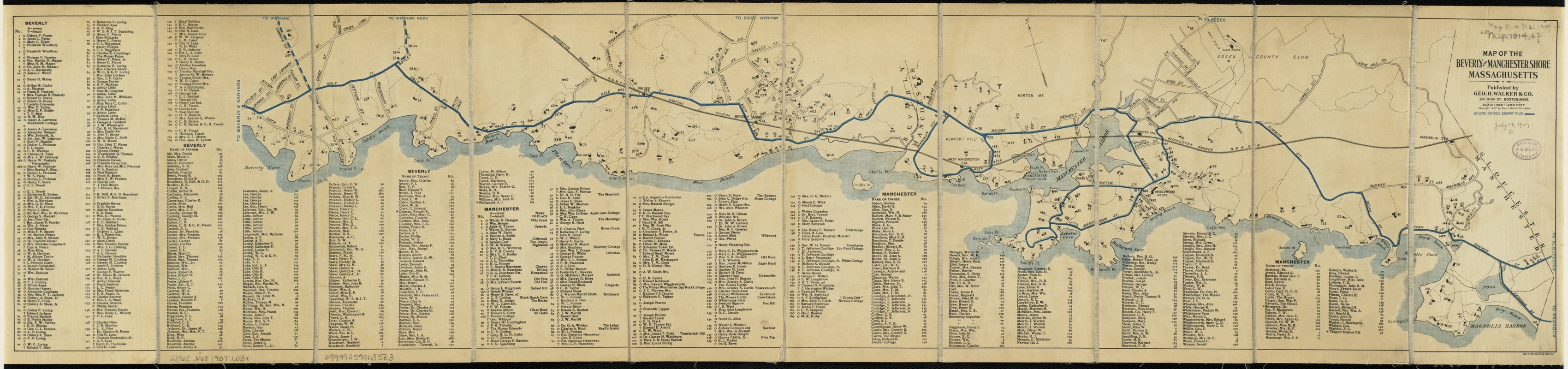
Map of the Beverly and Manchester shore Massachusetts
Item Information
- Title:
- Map of the Beverly and Manchester shore Massachusetts
- Creator:
- Geo. H. Walker & Co
- Date:
-
[ca. 1907]
- Format:
-
Maps/Atlases
- Location:
-
Boston Public Library
Norman B. Leventhal Map Center - Collection (local):
-
Norman B. Leventhal Map Center Collection
- Subjects:
-
Landowners--Massachusetts--Beverly--Maps
Landowners--Massachusetts--Manchester--Maps
North Shore (Mass. : Coast)--Maps
Beverly (Mass.)--Maps
Manchester (Mass. : Town)--Maps
- Places:
-
Essex (county)Beverly
Essex (county)Manchester
- Extent:
- 1 map : col. ; 23 x 107 cm.
- Terms of Use:
-
No known copyright restrictions.
No known restrictions on use.
- Publisher:
-
Boston :
Geo. H. Walker & Co.
- Scale:
-
Scale 1:14,400.
- Language:
-
English
- Notes:
-
Oriented with north toward the upper left.
- Identifier:
-
06_01_005382
- Call #:
-
G3762.N68 1907 .W3x
- Barcode:
-
39999059013563


