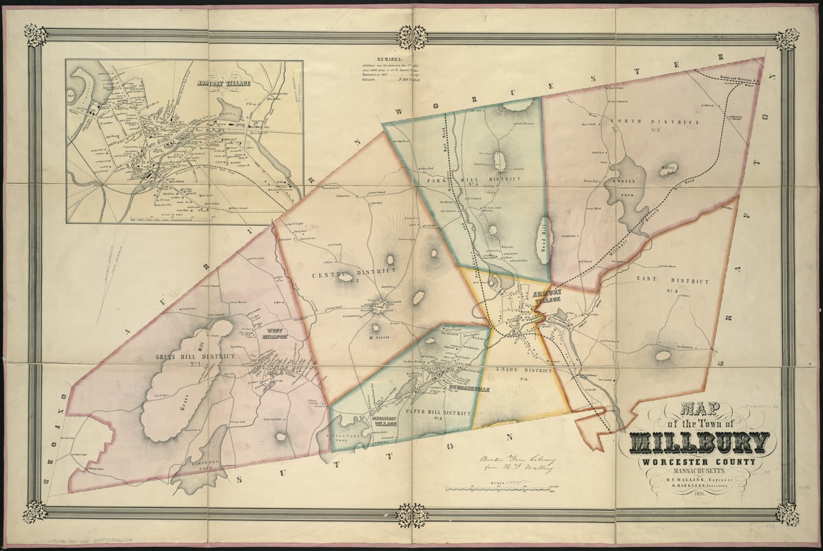
Map of the town of Millbury : Worcester County Massachusetts
Item Information
- Title:
- Map of the town of Millbury : Worcester County Massachusetts
- Creator:
- Walling, Henry Francis, 1825-1888
- Name on Item:
-
H.F. Walling, engineer ; O. Harkness, assistant.
- Date:
-
1851
- Format:
-
Maps/Atlases
- Location:
-
Boston Public Library
Norman B. Leventhal Map Center - Collection (local):
-
Norman B. Leventhal Map Center Collection
- Subjects:
-
Landowners--Massachusetts--Millbury--Maps
Millbury (Mass. : Town)--Maps
- Places:
-
Worcester (county)Millbury
- Extent:
- 1 map : col. ; 60 x 96 cm.
- Terms of Use:
-
No known copyright restrictions.
No known restrictions on use.
- Publisher:
-
S.l :
[H.F. Walling]
- Scale:
-
Scale [ca. 1:12,100].
- Language:
-
English
- Notes:
-
Relief shown by hachures.
Oriented with north toward the upper right.
Inset: Armory Village.
- Identifier:
-
06_01_005377
- Call #:
-
G3764.M78G46 1851 .W3x
- Barcode:
-
39999059013506