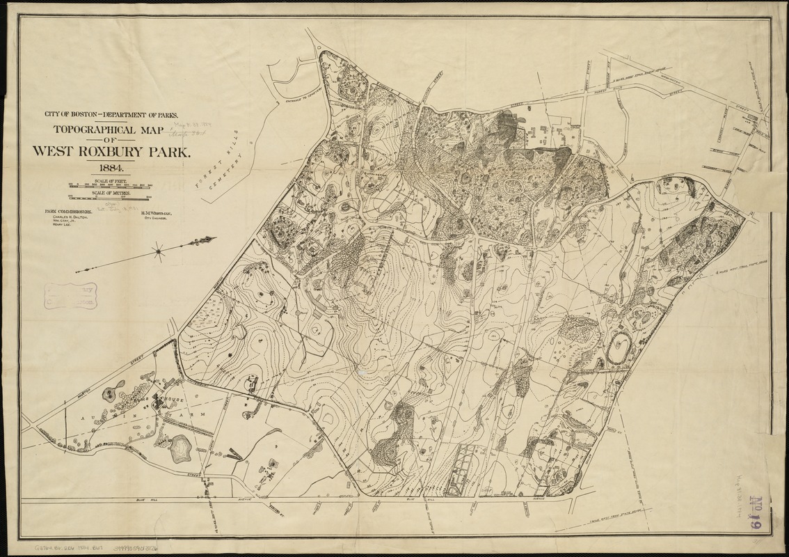
Topographical map of West Roxbury park
Item Information
- Title:
- Topographical map of West Roxbury park
- Creator:
- Boston (Mass.). Park Commissioners
- Date:
-
1884
- Format:
-
Maps/Atlases
- Location:
-
Boston Public Library
Norman B. Leventhal Map Center - Collection (local):
-
Norman B. Leventhal Map Center Collection
- Subjects:
-
Parks--Massachusetts--Boston--Maps
Franklin Park (Boston, Mass.)--Maps
Dorchester (Boston, Mass.)--Maps
- Places:
-
Suffolk (county)BostonFranklin Park
- Extent:
- 1 map ; 54 x 79 cm.
- Terms of Use:
-
No known copyright restrictions.
No known restrictions on use.
- Publisher:
-
Boston, Mass :
s.n.
- Scale:
-
Scale 1:2,400.
- Language:
-
English
- Notes:
-
Relief shown by contours and spot heights.
Oriented with north toward the upper right.
West Roxbury Park is now called Franklin Park.
- Identifier:
-
06_01_005331
- Call #:
-
G3764.B6:2D6 1884 .B67
- Barcode:
-
39999059013126


