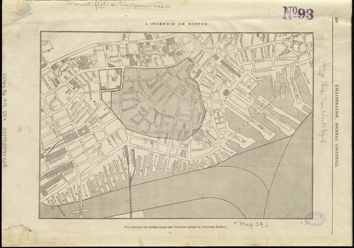
L'incendie de Boston : plan montrant les ravages causés par l'incendie (extrait de l'American Register)
Item Information
- Title:
- L'incendie de Boston : plan montrant les ravages causés par l'incendie (extrait de l'American Register)
- Date:
-
[1872]
- Format:
-
Maps/Atlases
- Location:
-
Boston Public Library
Norman B. Leventhal Map Center - Collection (local):
-
Norman B. Leventhal Map Center Collection
- Subjects:
-
Great Fire, Boston, Mass., 1872--Maps
Great Fire, Boston, Mass., 1872--Aerial views
Boston (Mass.)--Maps
- Places:
-
Suffolk (county)Boston
- Extent:
- 1 map ; 20 x 29 cm.
- Terms of Use:
-
No known copyright restrictions.
No known restrictions on use.
- Publisher:
-
Paris :
Dubochet
- Scale:
-
Scale not given.
- Language:
-
French
- Notes:
-
Appears in: L'Illustration, journal universel (23 Nov. 1872, p. 326).
On verso: View of the Great Fire in Boston, "L'Incendie de Boston."
- Notes (date):
-
This date is inferred.
- Identifier:
-
06_01_005330
- Call #:
-
G3764.B6 1872 .I5x
- Barcode:
-
39999059013118


