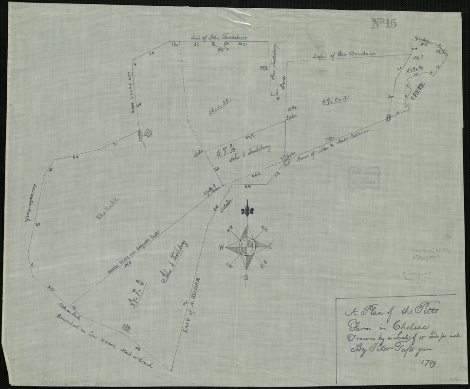
A plan of the Pitts Farm in Chelsea
This map is also available in American Revolutionary Geographies Online (ARGO), a collections portal especially built for material relating to the American Revolutionary War Era. Visit ARGO to learn more about this item and explore the historical geography of North America in the late eighteenth century.
Item Information
- Title:
- A plan of the Pitts Farm in Chelsea
- Creator:
- Tufts, Peter, Jr
- Name on Item:
-
by Peter Tufts.
- Date:
-
1799
- Format:
-
Maps/Atlases
Manuscripts
- Location:
-
Boston Public Library
Norman B. Leventhal Map Center - Collection (local):
-
Norman B. Leventhal Map Center Collection
- Subjects:
-
Landowners--Massachusetts--Chelsea--Maps, Manuscript
Real property--Massachusetts--Chelsea--Maps, Manuscript
Chelsea (Mass.)--Maps
- Places:
-
Suffolk (county)Chelsea
- Extent:
- 1 ms. map ; on sheet 46 x 57 cm.
- Terms of Use:
-
No known copyright restrictions.
No known restrictions on use.
- Scale:
-
Scale [ca. 1:2,970].
- Language:
-
English
- Identifier:
-
06_01_005240
- Call #:
-
G3764.C4G46 1799 .T8x
- Barcode:
-
39999059012243
![[Statement and plan of the Bill estate]](https://bpldcassets.blob.core.windows.net/derivatives/images/commonwealth:1257bc08v/image_thumbnail_300.jpg)
![[Plan of farm lands in Chelsea belonging to the Bill family]](https://bpldcassets.blob.core.windows.net/derivatives/images/commonwealth:1257bc069/image_thumbnail_300.jpg)