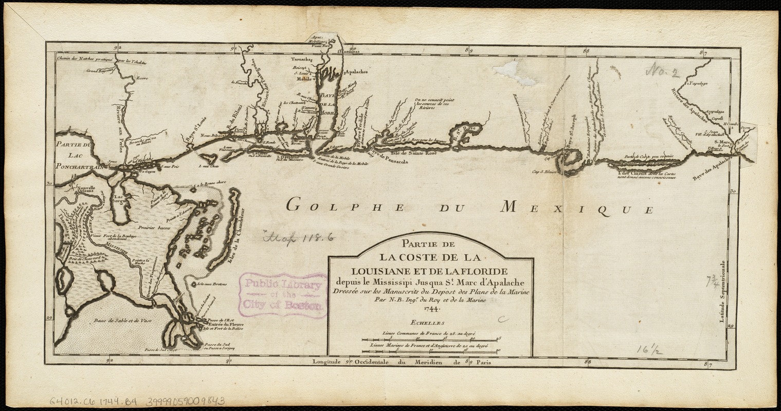
Partie de la coste de la Louisiane et de la Floride : depuis le Mississipi jusqua St. Marc d'Apalache
This map is also available in American Revolutionary Geographies Online (ARGO), a collections portal especially built for material relating to the American Revolutionary War Era. Visit ARGO to learn more about this item and explore the historical geography of North America in the late eighteenth century.
Item Information
- Title:
- Partie de la coste de la Louisiane et de la Floride : depuis le Mississipi jusqua St. Marc d'Apalache
- Creator:
- Bellin, Jacques Nicolas, 1703-1772
- Name on Item:
-
dressée sur les manuscrits du depost des plans de la Marine par N.B. Ingr. du Roy et de la Marine.
- Date:
-
1744
- Format:
-
Maps/Atlases
- Location:
-
Boston Public Library
Norman B. Leventhal Map Center - Collection (local):
-
Norman B. Leventhal Map Center Collection
- Subjects:
-
Coasts--Louisiana--Maps--Early works to 1800
Coasts--Florida--Maps--Early works to 1800
Florida--Maps--Early works to 1800
Louisiana--Maps--Early works to 1800
- Places:
-
Louisiana
Florida
- Extent:
- 1 map ; 21 x 44 cm.
- Terms of Use:
-
No known copyright restrictions.
No known restrictions on use.
- Publisher:
-
Paris :
[Pierre-François Giffart]
- Scale:
-
Scale [ca. 1:1,559,200].
- Language:
-
French
- Notes:
-
Prime meridian: Paris.
Appears in: Histoire et description generale de la Nouvelle France ... / Pierre-François Xavier Charlevoix. Paris: Pierre-François Giffart, 1744.
- Identifier:
-
06_01_005146
- Call #:
-
G4012.C6 1744 .B4
- Barcode:
-
39999059009843


![Chart of the sea coast from latitude 27⁰00ʹ00ʺ to 27⁰20ʹ00ʺ, with Little Inlet & River into Hillsborough River ; Chart of the sea coast from latitude 26⁰40ʹ00ʺ to [27⁰]00ʹ00ʺ, the Leech Shoal & Hillsborough River](https://bpldcassets.blob.core.windows.net/derivatives/images/commonwealth:q524nd97p/image_thumbnail_300.jpg)

