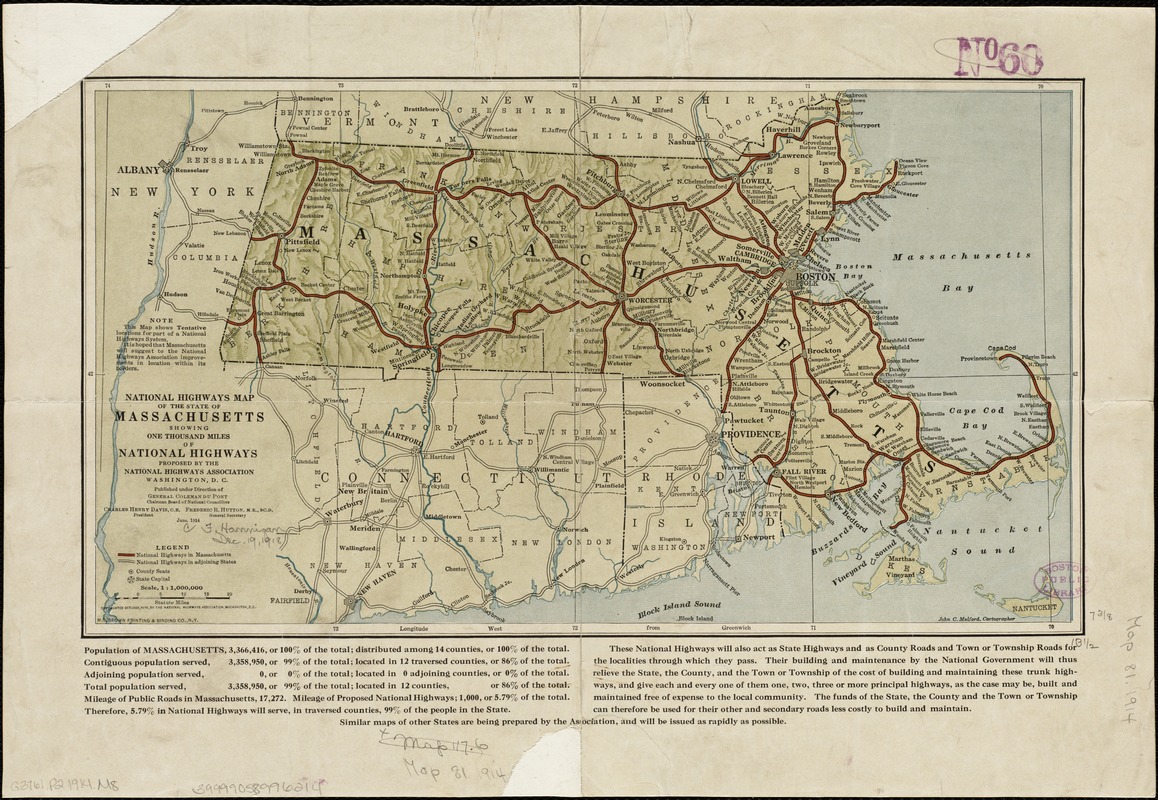
National Highways map of the state of Massachusetts showing one thousand miles of national highways proposed by the National Highways Association, Washington D.C
Item Information
- Title:
- National Highways map of the state of Massachusetts showing one thousand miles of national highways proposed by the National Highways Association, Washington D.C
- Creator:
- Mulford, John C.
- Name on Item:
-
John C. Mulford, cartographer ; published under direction of General Coleman du Pont, Charles Henry Davis, Frederic R. Hutton.
- Date:
-
1914
- Format:
-
Maps/Atlases
- Location:
-
Boston Public Library
Norman B. Leventhal Map Center - Collection (local):
-
Norman B. Leventhal Map Center Collection
- Subjects:
-
Roads--Massachusetts--Maps
Massachusetts--Maps
- Places:
-
Massachusetts
- Extent:
- 1 map : col. ; 19 x 34 cm.
- Terms of Use:
-
No known copyright restrictions.
No known restrictions on use.
- Publisher:
-
Washington, D.C :
National Highways Association
- Scale:
-
Scale 1:100,000
- Language:
-
English
- Notes:
-
Relief shown by shading.
- Identifier:
-
06_01_005121
- Call #:
-
G3761.P2 1914 .M8
- Barcode:
-
39999058996214


