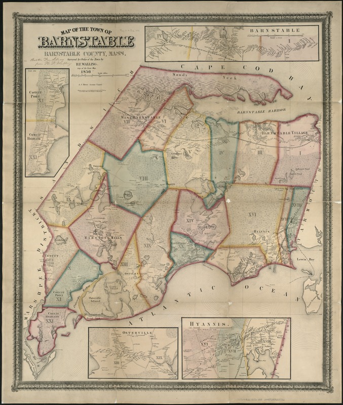
Map of the town of Barnstable, Barnstable County, Mass
Item Information
- Title:
- Map of the town of Barnstable, Barnstable County, Mass
- Creator:
- Walling, Henry Francis, 1825-1888
- Name on Item:
-
surveyed by order of the town by H.F. Walling.
- Date:
-
[1856?]
- Format:
-
Maps/Atlases
- Location:
-
Boston Public Library
Norman B. Leventhal Map Center - Collection (local):
-
Norman B. Leventhal Map Center Collection
- Subjects:
-
Barnstable (Mass.)--Maps
- Places:
-
Barnstable (county)Barnstable
- Extent:
- 1 map : col. ; 83 x 70 cm.
- Terms of Use:
-
No known copyright restrictions.
No known restrictions on use.
- Publisher:
-
S.l :
s.n.
- Scale:
-
Scale 1:25,000.
- Language:
-
English
- Notes:
-
Insets: Cotuiut Port and Cotuit Highland; Barnstable; Osterville; Hyannis.
- Identifier:
-
06_01_005105
- Call #:
-
G3764.B22 1856 .W3
- Barcode:
-
39999059009736


