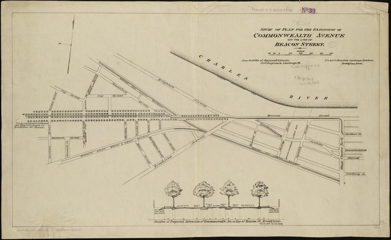
Study of plan for the extension of Commonwealth Avenue on the line of Beacon Street
Item Information
- Title:
- Study of plan for the extension of Commonwealth Avenue on the line of Beacon Street
- Creator:
- Olmsted, Frederick Law, 1822-1903
- Author:
- Olmsted, John C.
- Name on Item:
-
from the Office of Aspinwall & Lincoln ; F.L. & J.C. Olmsted.
- Date:
-
[1880?–1889?]
- Format:
-
Maps/Atlases
- Location:
-
Boston Public Library
Norman B. Leventhal Map Center - Collection (local):
-
Norman B. Leventhal Map Center Collection
- Subjects:
-
Streets--Massachusetts--Boston--Commonwealth Avenue
Back Bay (Boston, Mass.)--Maps
Fenway (Boston, Mass.)--Maps
- Places:
-
Suffolk (county)BostonBack Bay
Fenway/Kenmore
- Extent:
- 1 plan ; 51 x 89 cm.
- Terms of Use:
-
No known copyright restrictions.
No known restrictions on use.
- Publisher:
-
Boston :
[s.n.]
- Scale:
-
Scale 1:2,400.
- Language:
-
English
- Notes:
-
Oriented with north toward the upper right.
Includes section of proposed extension of Commonwealth Avenue on the line of Beacon St., Brookline.
- Identifier:
-
06_01_005099
- Call #:
-
G3764.B6:2F4 1880 .O4
- Barcode:
-
39999059009587


