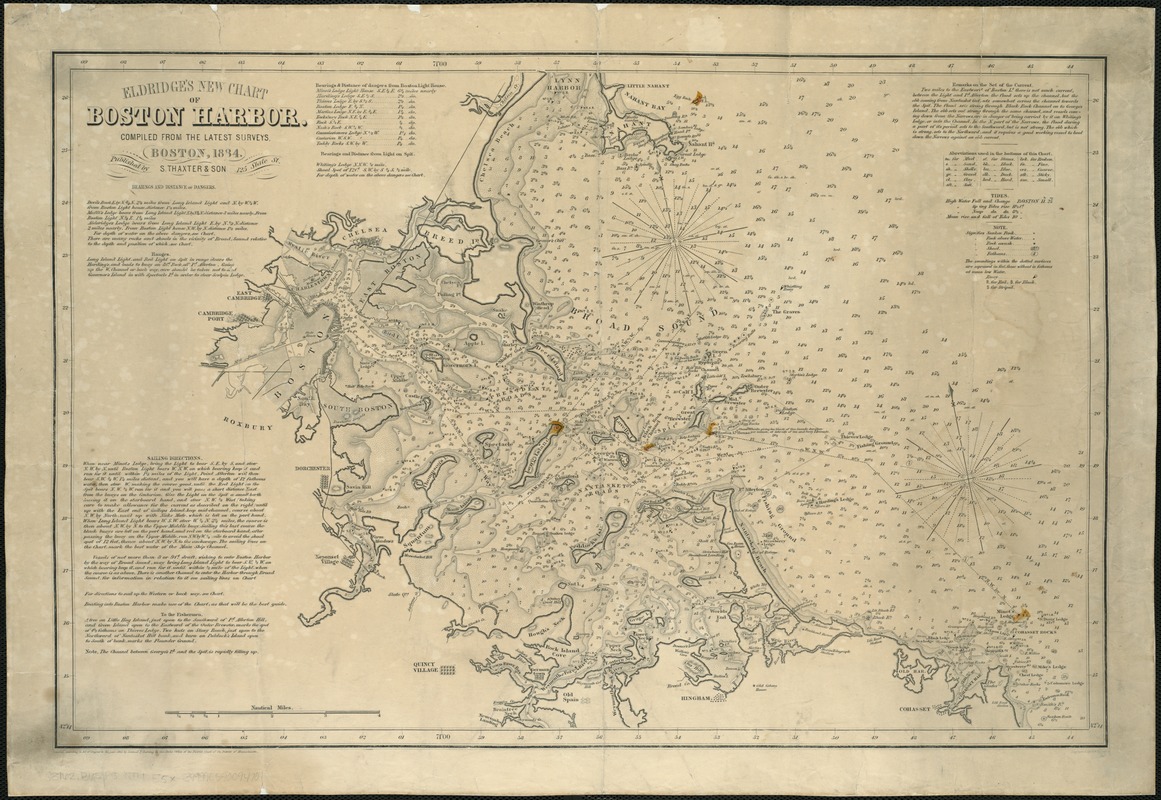
Eldridge's new chart of Boston Harbor : compiled from the latest surveys
Item Information
- Title:
- Eldridge's new chart of Boston Harbor : compiled from the latest surveys
- Creator:
- Eldridge, George, 1821-1879
- Date:
-
1884
- Format:
-
Maps/Atlases
- Location:
-
Boston Public Library
Norman B. Leventhal Map Center - Collection (local):
-
Norman B. Leventhal Map Center Collection
- Subjects:
-
Harbors--Massachusetts--Boston--Maps
Nautical charts--Massachusetts--Boston Bay
Nautical charts--Massachusetts--Boston Harbor
Boston Harbor (Mass.)--Maps
Boston Bay (Mass.)--Maps
- Places:
-
Boston Harbor
- Extent:
- 1 map ; 36 x 55 cm.
- Terms of Use:
-
No known copyright restrictions.
No known restrictions on use.
- Publisher:
-
Boston :
S. Thaxter & Son
- Scale:
-
Scale [ca. 1:64,820].
- Language:
-
English
- Notes:
-
Relief shown by hachures. Depths shown by soundings and shading.
In lower margin: Entered according to Act of Congress in the year 1865 by Samuel T. Cushing in the Clerk's Office of the District Court of the District of Massachusetts.
Includes life boat stations, light houses, buoys, text of sailing directions, dangers, and currents, and charts of bearings, bottom types, and tides.
- Identifier:
-
06_01_005094
- Call #:
-
G3762.B65P5 1884 .E5x
- Barcode:
-
39999059009470


