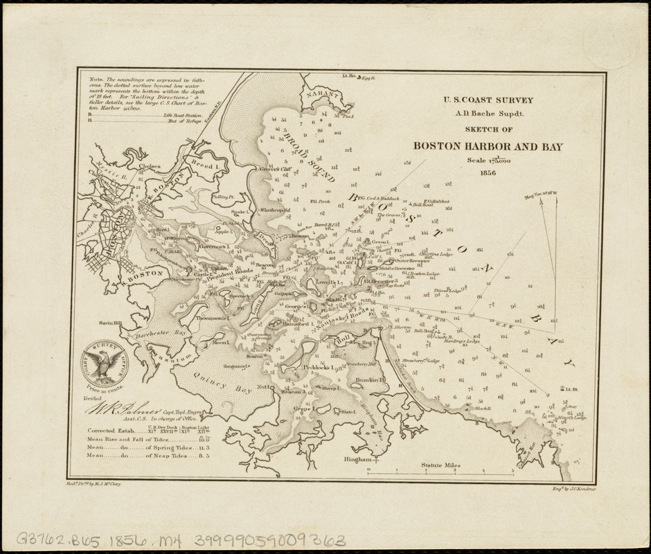
Sketch of Boston Harbor and Bay
Item Information
- Title:
- Sketch of Boston Harbor and Bay
- Creator:
- McClery, M. J.
- Name on Item:
-
U.S. Coast Survey, A.D. Bache, supdt. ; redd. drng. by M.J. McClery ; engd. by J.C. Kondrup.
- Date:
-
1856
- Format:
-
Maps/Atlases
- Location:
-
Boston Public Library
Norman B. Leventhal Map Center - Collection (local):
-
Norman B. Leventhal Map Center Collection
- Subjects:
-
Harbors--Massachusetts--Boston--Maps
Boston Harbor (Mass.)--Maps
Boston Bay (Mass.)--Maps
- Places:
-
Boston Harbor
- Extent:
- 1 map ; 13 x 17 cm.
- Terms of Use:
-
No known copyright restrictions.
No known restrictions on use.
- Publisher:
-
[Washington, D.C.] :
U.S. Coast Survey
- Scale:
-
Scale 1:175,000.
- Language:
-
English
- Notes:
-
Depths shown by soundings.
Includes table of tides, life boat stations, and huts of refuge.
Copy 2 mounted on cloth with "A chart exhibiting the normal course & velocity of the tidal current at ebb in Boston Harbor" / by A.D. Bache, superintendent U.S. Coast Survey. 1848.
- Identifier:
-
06_01_005011
- Call #:
-
G3762.B65 1856 .M4
- Barcode:
-
39999059009363


