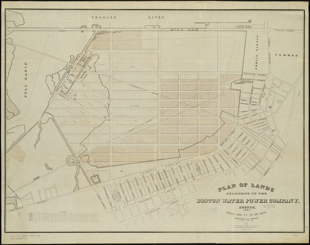
Plan of lands belonging to the Boston Water Power Company
Item Information
- Title:
- Plan of lands belonging to the Boston Water Power Company
- Creator:
- Whitwell & Henck
- Name on Item:
-
Whitwell & Henck, engineers & surveyors ; L.H. Bradford & Co's Lith.
- Date:
-
[1855]
- Format:
-
Maps/Atlases
- Location:
-
Boston Public Library
Norman B. Leventhal Map Center - Collection (local):
-
Norman B. Leventhal Map Center Collection
- Subjects:
-
Boston Water Power Company
Real property--Massachusetts--Boston--Back Bay--Maps
Landowners--Massachusetts--Boston--Maps
Boston (Mass.)--Maps
Back Bay (Boston, Mass.)--Maps
South End (Boston, Mass.)--Maps
- Places:
-
Suffolk (county)BostonBack Bay
MassachusettsSuffolk (county)BostonSouth End
- Extent:
- 1 map : col. ; 68 x 92 cm.
- Terms of Use:
-
No known copyright restrictions.
No known restrictions on use.
- Publisher:
-
Boston :
Whitwell & Henck
- Scale:
-
Scale 1:3,000.
- Language:
-
English
- Notes:
-
Shows areas in the Back Bay and the South End of Boston.
- Notes (date):
-
This date is inferred.
- Identifier:
-
06_01_005005
- Call #:
-
G3764.B6:B2G46 1855 .W45
- Barcode:
-
39999059009231

![[Plan of boundary lines in Roxbury and the City of Boston]](https://bpldcassets.blob.core.windows.net/derivatives/images/commonwealth:1257bb127/image_thumbnail_300.jpg)


