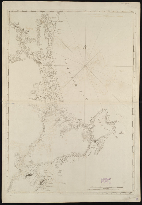
Coast of New Hampshire and Massachusetts from Great Boars Head to Marblehead Harbor
This map is also available in American Revolutionary Geographies Online (ARGO), a collections portal especially built for material relating to the American Revolutionary War Era. Visit ARGO to learn more about this item and explore the historical geography of North America in the late eighteenth century.
Item Information
- Title:
- Coast of New Hampshire and Massachusetts from Great Boars Head to Marblehead Harbor
- Creator:
- Des Barres, Joseph F. W. (Joseph Frederick Wallet), 1722-1824
- Date:
-
1781
- Format:
-
Maps/Atlases
- Location:
-
Boston Public Library
Norman B. Leventhal Map Center - Collection (local):
-
Norman B. Leventhal Map Center Collection
- Subjects:
-
Coasts--Massachusetts--Essex County--Maps--Early works to 1800
Coasts--New Hampshire--Rockingham County--Maps--Early works to 1800
Nautical charts--Massachusetts--Essex County--Early works to 1800
Essex County (Mass.)--Maps--Early works to 1800
Rockingham County (N.H.)--Maps--Early works to 1800
Atlantic Coast (N.H.)--Maps--Early works to 1800
- Places:
-
Essex (county)
Rockingham (county)
- Extent:
- 1 chart ; 107 x 74 cm.
- Terms of Use:
-
No known copyright restrictions.
No known restrictions on use.
- Publisher:
-
[London] :
J.F.W. Des Barres
- Edition:
- 1st state.
- Scale:
-
Scale [ca. 1:52,000]
- Language:
-
English
- Notes:
-
Relief shown by hachures. Depths shown by soundings.
Shows coast of Essex County, Massachusetts and part of Rockingham County, New Hampshire.
Appears in the author's Atlantic Neptune. London : J.F.W. Des Barres, 1777-[1781].
- Identifier:
-
06_01_004982
- Call #:
-
G1106.P5 D47 1777
- Barcode:
-
30000003808665


![[Coast of New England from York Harbor to North Beach]](https://bpldcassets.blob.core.windows.net/derivatives/images/commonwealth:7h149z874/image_thumbnail_300.jpg)
