A plan of Quebec and environs, with its defences and the occasional entrenched camps of the French commanded by Marquis de Montcalm : shewing likewise the principal works and operations of the British forces, under the command of Major General Wolfe, during the siege of that place in 1759
This map is also available in American Revolutionary Geographies Online (ARGO), a collections portal especially built for material relating to the American Revolutionary War Era. Visit ARGO to learn more about this item and explore the historical geography of North America in the late eighteenth century.
Item Information
- Title:
- A plan of Quebec and environs, with its defences and the occasional entrenched camps of the French commanded by Marquis de Montcalm : shewing likewise the principal works and operations of the British forces, under the command of Major General Wolfe, during the siege of that place in 1759
- Description:
-
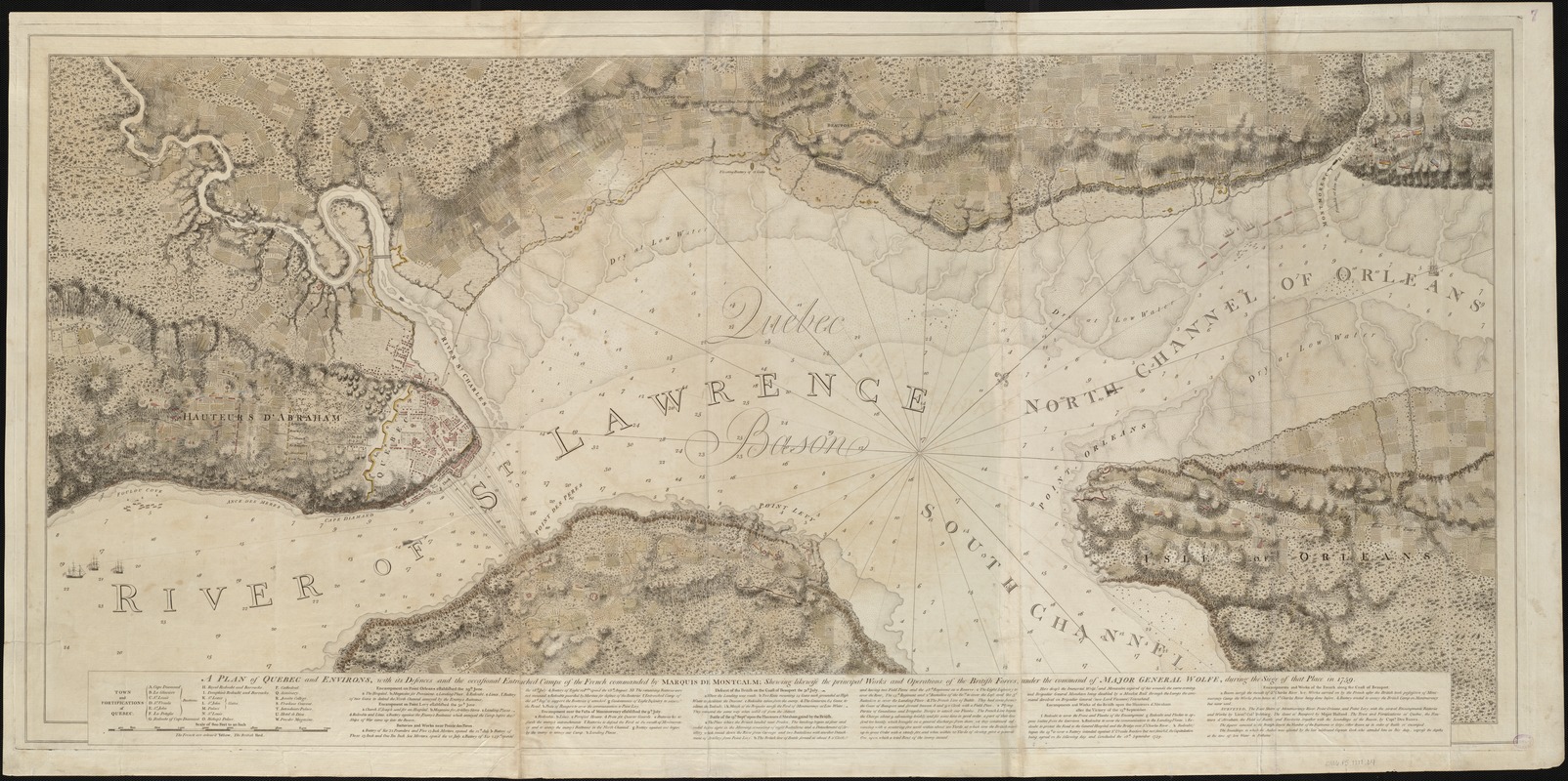
In addition to Ticonderoga and Louisbourg, Québec City was the other major French stronghold in northeastern North America. Its capture was critical to Britain's mission during the French and Indian War. This map delineates the positions of British and French troops during the 1759 siege of the city. The original surveys for this plan were prepared by Samuel Holland and J.F.W. Des Barres, after the capture of Québec. Des Barres surveyed the battlefield and fortifications on the Plains of Abraham, and took soundings in the harbor. A combination of scientific measurements and artistic skill, this plan exemplifies the care taken with each chart in The Atlantic Neptune.
- Creator:
- Des Barres, Joseph F. W. (Joseph Frederick Wallet), 1722-1824
- Date:
-
[1779?]
- Format:
-
Maps/Atlases
- Location:
-
Boston Public Library
Norman B. Leventhal Map Center - Collection (local):
-
Norman B. Leventhal Map Center Collection
- Subjects:
-
Nautical charts--Saint Lawrence River--Early works to 1800
Québec (Québec)--Maps--Early works to 1800
Saint Lawrence River--Maps--Early works to 1800
- Places:
-
CanadaQuebec (province)Québec
Saint Lawrence River
- Extent:
- 1 chart ; 63 x 149 cm.
- Terms of Use:
-
No known copyright restrictions.
No known restrictions on use.
- Publisher:
-
London :
[J.F.W. Des Barres]
- Scale:
-
Scale [ca. 1:10,000]
- Language:
-
English
- Notes:
-
Oriented with north toward the upper right.
Appears in the author's Atlantic Neptune. London : J.F.W. Des Barres, 1777-[1781].
- Notes (exhibitions):
-
Exhibited: "Charting an Empire: The Atlantic Neptune" organized by the Norman B. Leventhal Map Center at the Boston Public Library, 2013.
- Identifier:
-
06_01_004953
- Call #:
-
G1106.P5 D47 1777
- Barcode:
-
30000003804578
![[Bay of Seven Islands]](https://bpldcassets.blob.core.windows.net/derivatives/images/commonwealth:7h149v48t/image_thumbnail_300.jpg)
![[Chart of the coast of Quebec from the Riviere St. Jean to Grand Hermine Bay]](https://bpldcassets.blob.core.windows.net/derivatives/images/commonwealth:7h149v50v/image_thumbnail_300.jpg)
![[Chart of the gulf and river of St. Lawrence]](https://bpldcassets.blob.core.windows.net/derivatives/images/commonwealth:7h149v39v/image_thumbnail_300.jpg)

