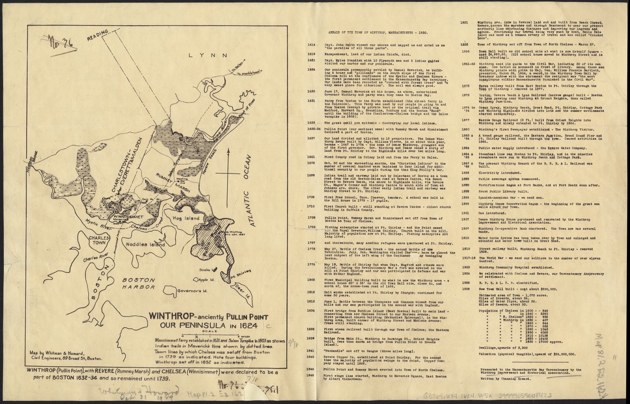
Winthrop - anciently Pullin Point : our peninsula in 1624
Item Information
- Title:
- Winthrop - anciently Pullin Point : our peninsula in 1624
- Creator:
- Whitman & Howard
- Engineer:
- Whitman & Howard
- Name on Item:
-
map by Whitman & Howard ; presented to the Massachusetts Bay Tercentenary by the Winthrop Improvement and Historical Association ; written by Channing Howard.
- Date:
-
[1930]
- Format:
-
Maps/Atlases
- Location:
-
Boston Public Library
Norman B. Leventhal Map Center - Collection (local):
-
Norman B. Leventhal Map Center Collection
- Subjects:
-
Winthrop (Mass.)--Maps
- Places:
-
Suffolk (county)Winthrop
- Extent:
- 1 map ; 24 x 18 cm.
- Terms of Use:
-
Rights status not evaluated.
This work is licensed for use under a Creative Commons Attribution Non-Commercial No Derivatives License (CC BY-NC-ND).

- Publisher:
-
Boston? :
s.n.
- Scale:
-
Scale [ca. 1:84,480.]
- Language:
-
English
- Notes:
-
Includes text on facing page: "Annals of the town of Winthrop, Massachusetts - 1930."
- Notes (date):
-
This date is inferred.
- Identifier:
-
06_01_004878
- Call #:
-
G3764.W84 1624 .W5x
- Barcode:
-
39999059008423