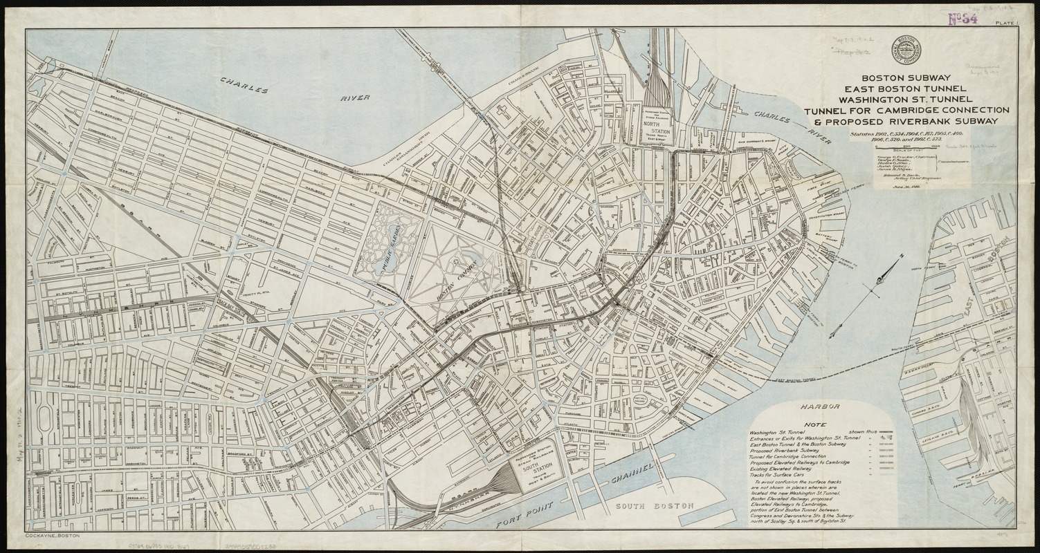
Boston Subway, East Boston Tunnel, Washington St. Tunnel, tunnel for Cambridge connection & proposed Riverbank Subway
Item Information
- Title:
- Boston Subway, East Boston Tunnel, Washington St. Tunnel, tunnel for Cambridge connection & proposed Riverbank Subway
- Creator:
- Boston (Mass.). Transit Commission
- Date:
-
1910
- Format:
-
Maps/Atlases
- Location:
-
Boston Public Library
Norman B. Leventhal Map Center - Collection (local):
-
Norman B. Leventhal Map Center Collection
- Subjects:
-
Subways--Massachusetts--Boston--Maps
Boston (Mass.)--Maps
- Places:
-
Suffolk (county)Boston
- Extent:
- 1 map : col. ; 59 x 116 cm.
- Terms of Use:
-
No known copyright restrictions.
No known restrictions on use.
- Publisher:
-
Boston :
Transit Commission
- Scale:
-
Scale [ca. 1:4,188].
- Language:
-
English
- Notes:
-
Oriented with north toward the upper right.
Cut from the 16th annual report of the Boston Transit Commission.
In upper right margin: Plate 1.
In lower left margin: Cockayne, Boston.
- Identifier:
-
06_01_004857
- Call #:
-
G3764.B6P33 1910 .B67
- Barcode:
-
39999059008233


