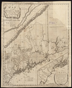
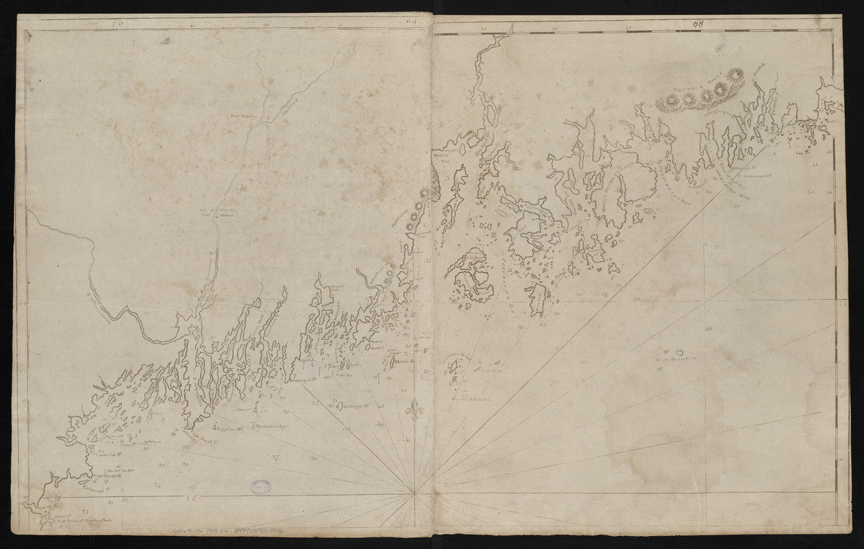
A chart of the Coast of America from Wood Island to Good Harbour from Hollands surveys
This map is also available in American Revolutionary Geographies Online (ARGO), a collections portal especially built for material relating to the American Revolutionary War Era. Visit ARGO to learn more about this item and explore the historical geography of North America in the late eighteenth century.
Item Information
- Title:
- A chart of the Coast of America from Wood Island to Good Harbour from Hollands surveys
- Title (alt.):
-
Coast of Maine from Fletcher's Neck to Mark Island
- Creator:
- Norman, John, 1748?-1817
- Cartographer:
- Norman, John, 1748?-1817
- Publisher:
- Norman, William, -1807
- Date:
-
[ca. 1798]
- Format:
-
Maps/Atlases
- Location:
-
Boston Public Library
Norman B. Leventhal Map Center - Collection (local):
-
Norman B. Leventhal Map Center Collection
- Subjects:
-
Coasts--Maine--Maps--Early works to 1800
Nautical charts--Maine--Maps--Early works to 1800
Maine--Maps--Early works to 1800
- Places:
-
Maine
- Extent:
- 1 map ; 52 x 85 cm
- Terms of Use:
-
No known copyright restrictions.
No known restrictions on use.
- Publisher:
-
[Boston] :
[William Norman]
- Scale:
-
Scale approximately 1:282,000
- Language:
-
English
- Notes:
-
Title from later edition. Alternate title supplied by cataloger.
Relief shown by hachures. Depths shown by soundings.
In Norman's The American pilot. Boston : William Norman, [approximately 1798].
- Identifier:
-
06_01_004826
- Call #:
-
G1106.P5 N6 1798.2x
- Barcode:
-
30000005069326