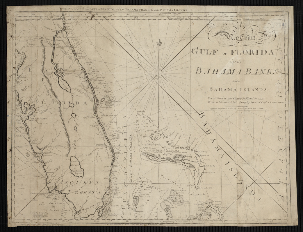
A new chart of the Gulf of Florida and Bahama Banks also the Bahama Islands taken from a new chart published in Cadiz from a late and actual survey by favor of Captn. T. Rogers
Item Information
- Title:
- A new chart of the Gulf of Florida and Bahama Banks also the Bahama Islands taken from a new chart published in Cadiz from a late and actual survey by favor of Captn. T. Rogers
- Title (alt.):
-
Peninsula and Gulf of Florida or New Bahama Channel with the Bahama Islands
- Publisher:
- Allen, Andrew J., 1784 or 1785-1863
- Date:
-
1816
- Format:
-
Maps/Atlases
- Location:
-
Boston Public Library
Norman B. Leventhal Map Center - Collection (local):
-
Norman B. Leventhal Map Center Collection
- Subjects:
-
Coasts--Florida--Maps--Early works to 1800
Bahamas--Maps--Early works to 1800
Florida, Straits of--Maps--Early works to 1800
Great Bahama Bank (Bahamas)--Maps--Early works to 1800
Little Bahama Bank (Bahamas)--Maps--Early works to 1800
- Places:
-
Bahamas
Florida, Straits of
Great Bahama Bank
Little Bahama Bank
- Extent:
- 1 map ; 46 x 60 cm
- Terms of Use:
-
No known copyright restrictions.
No known restrictions on use.
- Publisher:
-
Boston :
J. Norman [that is, Andrew J. Allen]
- Scale:
-
Scale approximately 1:1,370,000
- Language:
-
English
- Notes:
-
Relief shown pictorially. Depths shown by soundings.
Prime meridians: Ferro, Cadiz and London.
In lower margin: London published by Laurie & Whittle Boston republished 1815.
In The American pilot. Boston : Andrew J. Allen, [1816].
- Identifier:
-
06_01_004819
- Call #:
-
G1106.P5 A4 1816x
- Barcode:
-
30000005069402