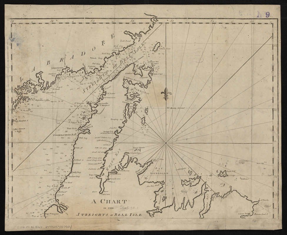
A chart of the Streights of Bell Isle
Item Information
- Title:
- A chart of the Streights of Bell Isle
- Creator:
- Norman, John, 1748?-1817
- Cartographer:
- Norman, John, 1748?-1817
- Publisher:
- Allen, Andrew J., 1784 or 1785-1863
- Date:
-
[1816]
- Format:
-
Maps/Atlases
- Location:
-
Boston Public Library
Norman B. Leventhal Map Center - Collection (local):
-
Norman B. Leventhal Map Center Collection
- Subjects:
-
Coasts--Newfoundland and Labrador--Maps--Early works to 1800
Nautical charts--Newfoundland and Labrador--Belle Isle, Strait of--Maps--Early works to 1800
Belle Isle, Strait of (N.L.)--Maps--Early works to 1800
- Places:
-
CanadaBelle Isle, Strait of
- Extent:
- 1 map ; 51 x 42 cm
- Terms of Use:
-
No known copyright restrictions.
No known restrictions on use.
- Publisher:
-
[Boston] :
[Andrew J. Allen]
- Scale:
-
Scale approximately 1:835,000
- Language:
-
English
- Notes:
-
Depths shown by soundings.
In The American pilot. Boston : Andrew J. Allen, [1816].
- Notes (date):
-
This date is inferred.
- Identifier:
-
06_01_004817
- Call #:
-
G1106.P5 A4 1816x
- Barcode:
-
30000005069395