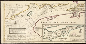
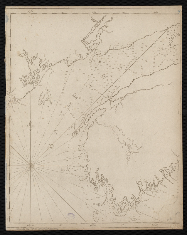
Chart of the Bay of Fundy from Machias Bay to 64°35' west longitude
Item Information
- Title:
- Chart of the Bay of Fundy from Machias Bay to 64°35' west longitude
- Title (alt.):
-
Bay of Fundy
- Publisher:
- Norman, John, 1748?-1817
- Date:
-
[1794]
- Format:
-
Maps/Atlases
- Location:
-
Boston Public Library
Norman B. Leventhal Map Center - Collection (local):
-
Norman B. Leventhal Map Center Collection
- Subjects:
-
Coasts--New Brunswick--Early works to 1800
Coasts--Nova Scotia--Early works to 1800
Nautical charts--Fundy, Bay of--Early works to 1800
Fundy, Bay of--Maps--Early works to 1800
- Places:
-
CanadaFundy, Bay of
- Extent:
- 1 map ; 51 x 43 cm
- Terms of Use:
-
No known copyright restrictions.
No known restrictions on use.
- Publisher:
-
[Boston] :
[John Norman]
- Scale:
-
Scale approximately 1:353,500
- Language:
-
English
- Notes:
-
Title from Wheat & Brun.
Depths shown by soundings.
In Norman's American pilot. Boston : John Norman, 1794.
- Notes (date):
-
This date is inferred.
- Identifier:
-
06_01_004806
- Call #:
-
G1106.P5 N6 1794x
- Barcode:
-
30000005258363